Now, here’s a graphic illustration of the importance of wildlife corridors. Impressive . . .
Step off Montana Highway 200 at Rogers Pass, hop on the back of a wolverine, and you would cross pavement just three times before reaching Banff, Alberta.
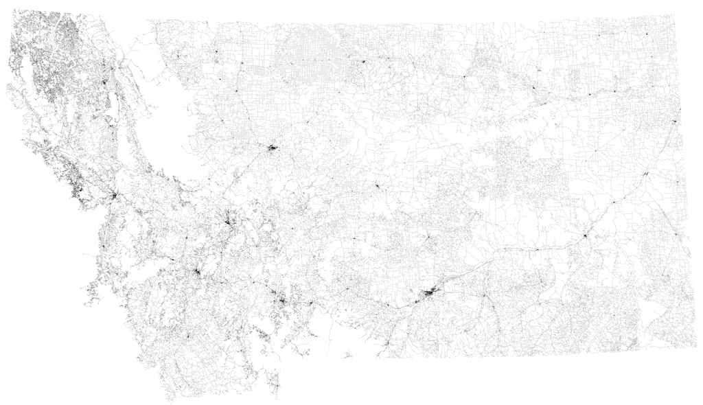
Two of those roads, U.S. Highway 2 and Going-to-the-Sun Road, cross the otherwise blank spot on an unusual map that’s been floating around the Internet recently. The map, assembled by Reddit user WestCoastBestCoast94, displays virtually all the nation’s roads – and nothing else. The resulting black-and-white representation of the Lower 48 tends to get one common response:
Wow.
The United States has about 4 million miles of public roads. According to federal highway statistics, 97 percent of the continental U.S. is less than three miles away from a road. Eighty-three percent lies within half a mile. A recent analysis prepared by the Western Transportation Institute at Montana State University looked at the unroaded areas of Montana, Idaho and Wyoming – three states with the least population density short of Alaska – and found that 16 percent of their combined territory qualified as essentially roadless. The study included national parks, which do have some roads.