From a recent announcement on the Northeast Kootenai Complex InciWeb site . . .
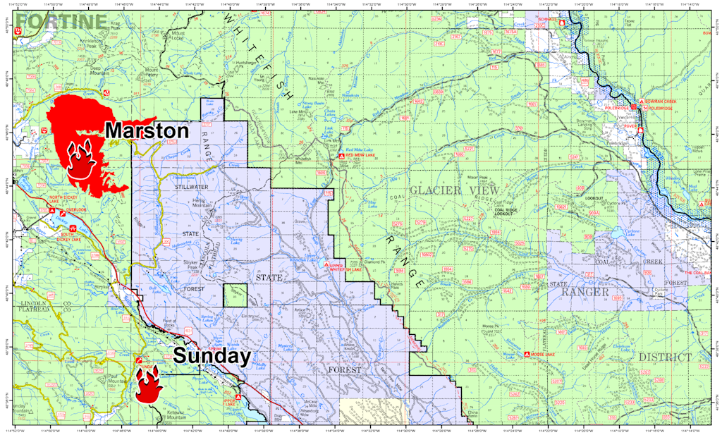
A map of the Marston and Sunday Fires of the Northeast Kootenai Complex showing their proximity to the Flathead National Forest is now posted here on InciWeb and also under the “Maps” tab. This should give residents in Polebridge and other nearby residential areas a better view of the proximity of the Marston Fire to where they live. The fire has NOT moved onto the Flathead National Forest and is approximately 20 miles away from Polebridge. Residents who are concerned about the fire are asked to contact the Northeast Kootenai Complex Fire Information Line at (406) 882-8308 and stay updated on the incident through the Northeast Kootenai Complex InciWeb site.
See/click on the map below. For a full resolution version, download the PDF version (1.3MB).
2 thoughts on “Northeast Kootenai Complex Proximity to Flathead NF Map, Aug 29”
Comments are closed.