As is usual this time of year, our “Wildfire Information” page has gotten a few updates.
The “Wildfire Information” page is a collection of wildland fire information links, including prescribed burns, applicable to the Flathead and Kootenai National Forests and Glacier National Park. There’s also a group of links for Canadian wildfire information.
And remember . . .
TO REPORT A WILDLAND FIRE – CALL (406) 758-5260 OR CALL 911
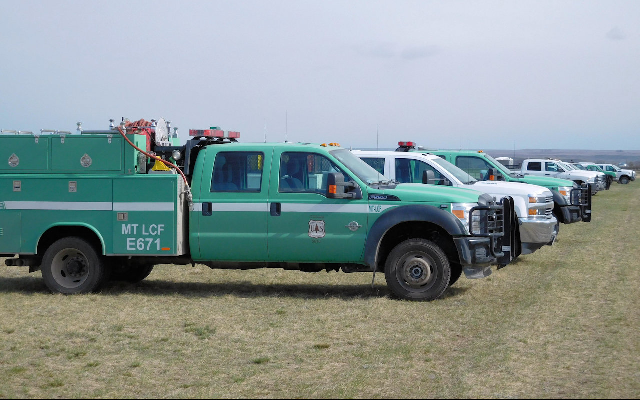
Fire engines at Elk Hill Fire, April 13, 2016 – USFS photo
Stick a fork in it. It’s done. Some 10 inches of snow last Thursday night and Friday helped finish off the 1086-acre Elk Hill Fire in the Bob Marshall Wilderness.
As of Friday afternoon, there were 20 people still assigned to the blaze, down from a peak of 50. The fire is 100% contained. All area trails are reopened.
The total cost for putting out someone’s neglected campfire was around $575,000.
Fire engines at Elk Hill Fire, April 13, 2016 – USFS photo
Firefighting personnel continue dealing with the Elk Hill Fire, a 1068-acre blaze burning in the Bob Marshall Wilderness. The fire is 60% contained and continues to burn with its existing perimeter. According to the InciWeb site, “Suppression efforts will continue on the north and east edges of the fire.”
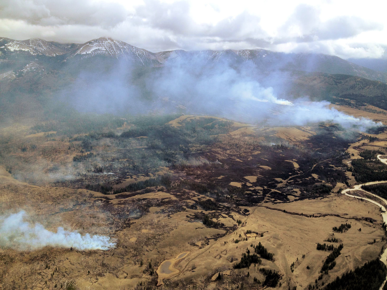
Elk Hill Fire, aerial view. April 10, 2016 – USFS photo
Firefighting personnel continue dealing with the Elk Hill Fire, a 1068-acre blaze burning in the Bob Marshall Wilderness. The fire is now 60% contained, with further progress expected today.
Some 45 people are assigned to the effort. Three helicopters are making water drops. A Type 2 team started work yesterday.
According to the InciWeb site, “Fire personnel will remain working on the north edge in the heavier dead and down fuel (within the 2005 fire’s burned area), while the Type-2 fire crew will move to the east-side of the fire today, after making progress yesterday on the south edge.”
Firefighting personnel continue dealing with the Elk Hill Fire, a 1068-acre blaze burning in the Bob Marshall Wilderness. Fifty people (up from 30 yesterday) are tied up with the effort so far. Three helicopters are making water drops. A Type 2 team is going in today.
The fire is still uncontained, although it doesn’t appear to be spreading significantly.
In general, not much has changed since our previous post, except for the increased number of folks on the ground.
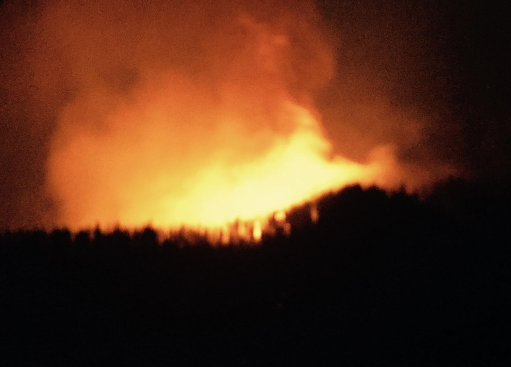
Elk Hill Fire, Lewis and Clarke NF, April 9, 2016 – USFS photo
Personnel from the Lewis and Clarke National forest are busy suppressing the Elk Hill Fire, a 1000-acre blaze burning in the Bob Marshall Wilderness. Thirty people are tied up with the effort so far, as well as three helicopters. (Update: There are no significant changes as of April 11 at 10am.)
The Elk Hill fire appears to have been started by a warming or campfire, but is under investigation.
Currently the fire is actively burning near lower North Fork Sun River, southeast of the Forest Service cabin on Cabin Creek, in the Bob Marshall Wilderness on the Rocky Mountain Ranger District. The Elk Hill Fire is burning in grass, and in downfall within the perimeter of a wildfire from 2005, moving into stands of mature Douglas fir. Although the weather is warm, this fire is primarily fuels-driven with potential for continued rapid spread.
The most active part of the fire is along Circle Creek in/around the 2005 fire area, because of the dead and down fuels within that area.
Fire personnel are continuing suppression efforts where it is safe to do so; and focus structure protection of the Forest Service Cabin Creek cabin. Three helicopters–one Type 1 and two Type-2–are assisting the on-the-ground efforts, as needed.
UPDATED TRAILS CLOSURES:
–North Fork Sun River Trail #201 from jct. w/#268 north to jct. w/#231.1 (northwest of Cabin Creek Cabin).
–Circle Creek Trail #231 from jct. w/#201 north to #231.1 and southeast to jct. w/#208.
–Cabin Creek Admin. Connector #231.1 closed in it’s entirety.
–Circle Creek Connector #268.1 closed in it’s entirety.
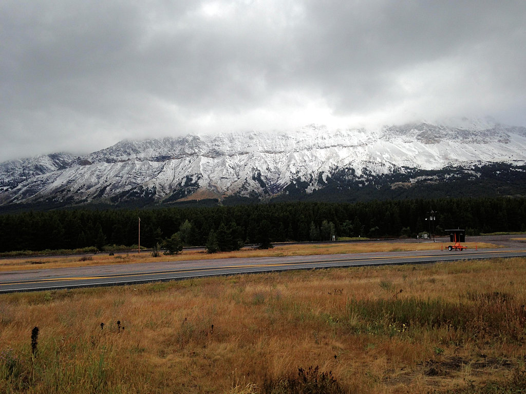
The snow layer dipped close to Marias Pass, MT, at elevations around 6,000 ft. north of the Thompson-Divide Complex’s Granite Fire Sept. 6, 2015. (photo Jonathan Moor)
Here’s the morning update for the Thompson-Divide Complex fires, including the Granite, Sheep and Thompson fires. Things are really winding down. This is the last regular update . . .
This is the Final Fact Sheet for the Thompson-Divide Complex from Northern Rockies Type II Incident Management Team Leach. Link to http://inciweb.nwcg.gov/incident/4468/
Fire Complex Completed: 72% Injuries: 1 Structures Lost: None
Resources – Total Personnel: 87 Engines: 2
Cause of Fires: All three fires have been determined to be lightning caused.
The Thompson-Divide Complex consists of the Sheep and Granite Fires in the Flathead National Forest and the Thompson Fire in Glacier National Park.
All travel restrictions on U.S. Highway 2 related to the fires have been lifted. Motorists are cautioned to still drive carefully because fire traffic are still using this route for rehabilitation efforts.
Stage I Fire Restrictions are in effect for Glacier National Park and Flathead National Forest, except wilderness areas. Stage I Restrictions allow for campfires only in designated fire rings. All fire restrictions have been dropped in the Flathead National Forest Wilderness areas.
Closures are in effect for some trails and areas in the vicinity of the fires. Cutbank Pass and Nyack area trails remain closed. For more information on Glacier NP closures, see http://www.nps.gov/glac/planyourvisit/hikingthetrails.htm or call (406) 888-7800. An area closure around the Sheep and Granite fires on the Flathead National Forest is in effect. Call Hungry Horse Ranger District (406) 387-3800 or go to http://inciweb.nwcg.gov/incident/article/4468/28364/ for details.
The Thompson-Divide Complex received more than an inch of rain in some areas over the past two days and some snow at elevations above 6,000 ft. Today temperatures will be 50-60. There is a 20% chance of showers and thunderstorms. Weather is predicted to return to average temperatures and begin drying mid-week. Smoke from interior hot spots and burning logs may be seen during the week as fuels dry.
Crews will complete hand rehabilitation and remove protective wrap from cabins today. Fires will be monitored for any activity near the perimeters of the Sheep and Granite Fires. Management of the Thompson-Divide Complex is transferring from the Northern Rockies Type II IMT to a local Type 4 team on Monday, Sept. 7 at 6 p.m. The Type 4 team will be located at the Hungry Horse Ranger Station and will continue to monitor all three fires for any fire activity and complete needed rehabilitation.
Sheep Fire, Flathead National Forest
Approximate Size: 2,171 acres
Granite Fire, Flathead National Forest
Approximate Size: 913 acres
Thompson Fire, Glacier National Park
Approximate Size: 18,847 acres
The Northern Rockies Type II Incident Management Team Leach thanks the community, our partners and cooperators for all their support and assistance during this incident.
The cool, wet weather has really knocked things down. South of Glacier Park, the Essex evacuation order is cancelled and traffic on U.S. Highway 2 through the area is back to normal. Locally, the forest closure in the North Fork was lifted, as well as most of the closures in the Kootenai Forest. Trail Creek Road is open all the way through. Quite a few fire crews are demobilizing.
Here’s an overview of conditions throughout the region . . .
Cool, rainy conditions in the Fortine area were favorable enough on the Marston Fire that the fire management team and Flathead and Kootenai national forests have lifted most of the land closures in the Whitefish Range.
That team is managing several fires, including the one burning on and around Marston Mountain that has covered 7,000 acres.
Spokesman Tom Rhodes said the Flathead National Forest has rescinded all of its closures in the Glacier View Ranger District and most of the Kootenai-managed Ten Lakes area has reopened with the exception of Sinclair Creek Trail.
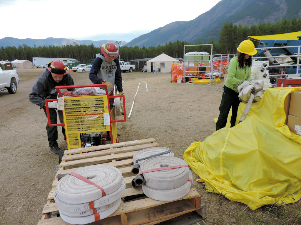
Receiving & Distribution Mngr. Rick Sendra and Patrick Gomez roll hoses as Keesha Williams unbunches hose from the Thompson Fire, Sept. 2. Gomez is a Natural Resources Specialist and Williams is a Welder from Trapper Creek Job Corps.
Here’s the morning update for the Thompson-Divide Complex fires, including the Granite, Sheep and Thompson fires.
The recent, cool, damp weather is really taking effect. The Sheep Fire, which triggered an evacuation order for Essex a few days ago has laid down considerably. The Essex evacuation order is now lifted and travel on U.S. Route 2 through the area is back to normal, no longer controlled with pilot cars.
Crews are demobilizing. Fire management is being turned over to Glacier Park and the Flathead National Forest.
Resources – Total Personnel: 213 Injuries: 1 Structures Lost: None
20-Person Hand Crews: 2 Type-1 and 1 Type-2 Air Support: Helicopters (2 Type-1 & 2 Type-3), Engines: 4
Cause of Fires: All three fires have been determined to be lightning caused.
The Thompson-Divide Complex consists of the Sheep and Granite Fires in the Flathead National Forest and the Thompson Fire in Glacier National Park. The Sheep Fire is the incident priority due to its proximity to US Hwy. 2, BNSF railway and the community of Essex. Crews and equipment will continue to demobilize today. Today there will be rehabilitation efforts on all three fires. The camp crew has rolled up over 9 miles of hose line so far from the three fires.
The evacuation order for the Essex area will lift today at 8:00 am. For more information, call the Flathead County Office of Emergency Services at (406) 758-2111.
The pilot car escort will end today at 8:00 am, with unrestricted travel on U.S. Highway 2. Motorists are cautioned to drive carefully because of fire traffic along this route. For current road status, call 511 or visit http://www.mdt.mt.gov/travinfo/alerts.shtml.
Closures are in effect for some trails and areas in the vicinity of the fires. As of Sept 1 all of the trails in the Two Medicine and Cutbank Valley are open, including the Dawson-Pitamakan Loop. The Cutbank Pass and Nyack area trails remain closed for visitor safety. For more information on Glacier NP closures, please see http://www.nps.gov/glac/planyourvisit/hikingthetrails.htm or call 405-888-7800. An area closure around the Sheep and Granite fires on the Flathead National Forest is in effect. Call Hungry Horse Ranger District (406) 387-3800 or go to http://inciweb.nwcg.gov/incident/article/4468/28364/ for details.
There is a 60% chance of showers this Friday afternoon with temperatures around 51-56. The humidity is expected to be 55-60. Winds will be 5-10 mph with 15 mph gusts. Continued minimal fire activity through the weekend is expected due to wet, cool weather and increased fuel moisture.
Fire Update: The Sheep Fire is on the Flathead National Forest and burning in very steep terrain with limited access. The fire is about 1 mile south of Essex and about 1/8 mile from the train tracks between Tank Creek and McDonald Creek. The fire showed little activity again yesterday. Structural protection measures have been removed. Crews will continue to monitor and haul out equipment. The team will begin to rehabilitate fire lines and other disturbed areas around the Sheep Fire.
Granite Fire, Flathead National Forest
Approximate Size: 913 acres
Fire Update: The Granite Fire is located west of Marias Pass and south of U.S. Hwy. 2. The fire started in the Great Bear Wilderness and has moved north out of the Wilderness. There has been little fire activity the past few days. One engine and crew are using existing roads to monitor the fire’s activity. Excess equipment is being hauled out.
Fire Update: The Thompson Fire is located in remote southern backcountry of Glacier National Park about 15 miles east of the West Glacier entrance in the Thompson and Nyack drainages west of the Continental Divide. Aircraft will continue to monitor the fire.
Most of Glacier National Park is unaffected by this wildfire complex and is available for recreational use. The Thompson Fire has not impacted park roads. The Going-to-the-Sun Road is open.
Here’s the morning update for the Thompson-Divide Complex fires, including the Granite, Sheep and Thompson fires.
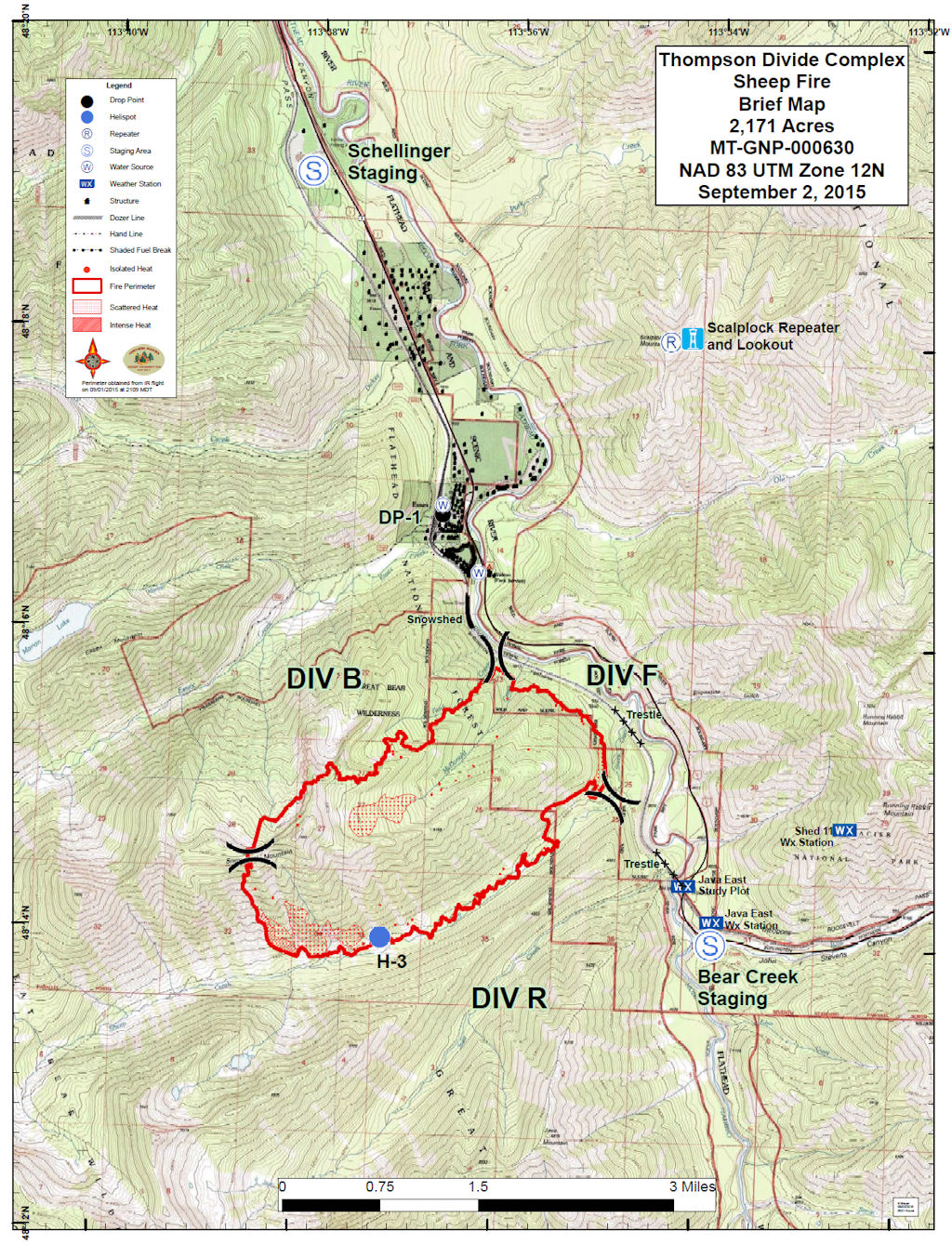
The big news continues to be the Sheep Fire (see map below), which triggered an evacuation order for Essex a few days ago. The Essex evacuation order was subsequently lifted and U.S. Route 2 was reopened for traffic using pilot cars to keep things orderly. However, authorities are still edgy about Essex and warned residents to be ready to evacuate on short notice. The arrival of cooler, wetter weather has helped firefighters throughout the region.
Seems like the Sheep Fire should have a scarier name, doesn’t it?
Fire Complex Completed: 38%
Resources – Total Personnel: 262, Injuries: 1 Structures Lost: None
20-Person Hand Crews: 2 Type-1 and 2 Type-2 Air Support: Helicopters (2 Type-1 & 2 Type-3), Engines: 8
Heavy Equipment: 7 Cause of Fires: All three active fires have been determined to be lightning caused.
The Thompson-Divide Complex consists of the Sheep and Granite Fires in the Flathead National Forest and the Thompson Fire in Glacier National Park. The Sheep Fire is the incident priority due to its proximity to US Hwy. 2, BNSF railway and the community of Essex. Crews and equipment will continue to demobilize today as the need diminishes.
The Essex area is in the ‘Set’ Stage of the Ready, Set, Go evacuation model. Residents are advised to remain prepared to evacuate if conditions again warrant this action. For more information, call the Flathead County Office of Emergency Services at (406) 758-2111.
U.S. Highway 2 is open with pilot cars escorting traffic between mileposts 176.5 and 185. Escorted vehicles are not allowed to stop in this area. BNSF and Amtrak trains are running. For current road status, call 511 or visit http://www.mdt.mt.gov/travinfo/alerts.shtml. For more information on Amtrak, call (800) 872-7245.
Sheep and Granite fires received up to .25 inches of rain last night. Low pressure weather patterns will continue to affect the area thru the weekend, with the possibility of air operations being limited by a low ceiling today. Maximum temperatures will be in the low 60s. Winds are forecast to be lighter today, with a 90% chance of showers. Continued minimal fire activity through the weekend is expected due to increased moisture in fuels and weather conditions.
Fire Update: The Sheep Fire is on the Flathead National Forest and burning in very steep terrain with limited access. The fire is about 1 mile south of Essex and about 1/8 mile from the train tracks between Tank Creek and McDonald Creek. The fire again showed little activity yesterday. Firefighters will continue to patrol and put out hotspots in the Sheep Creek and Tank Creek drainages and remove hoses and pumps from the snowshed and rail yard in Essex. Structural protection measures are in place in Essex.
Fire Update: The Granite Fire is located west of Marias Pass and south of U.S. Hwy. 2. The fire started in the Great Bear Wilderness and has moved north out of the Wilderness. There has been little fire activity the past few days. One engine and crew are using existing roads to monitor the fire’s activity.
Fire Update: The Thompson Fire is located in remote southern backcountry of Glacier National Park about 15 miles east of the West Glacier entrance in the Thompson and Nyack drainages west of the Continental Divide. Monitoring of fire activity will continue with aircraft.
Most of Glacier National Park is unaffected by this wildfire complex and is available for recreational use. The Thompson Fire has not impacted park roads. The Going-to-the-Sun Road is open.