Here’s this morning’s report on the Northeast Kootenai Complex fires.
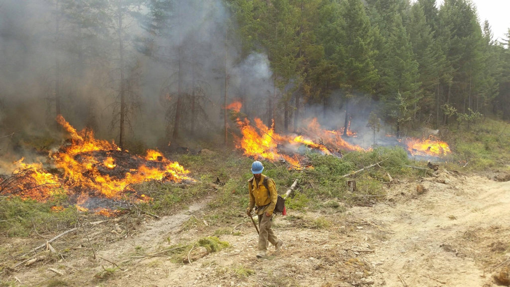
Of greatest interest to North Forkers is the Marston Fire, which made a run to the northeast recently, resulting in a precautionary closure of a section of the Flathead National Forest in the North Fork. The cooler, wetter weather that moved into the area has made life easier for crews fighting this blaze. It is still not anywhere close to the North Fork and has not grown over the last 24 hours.
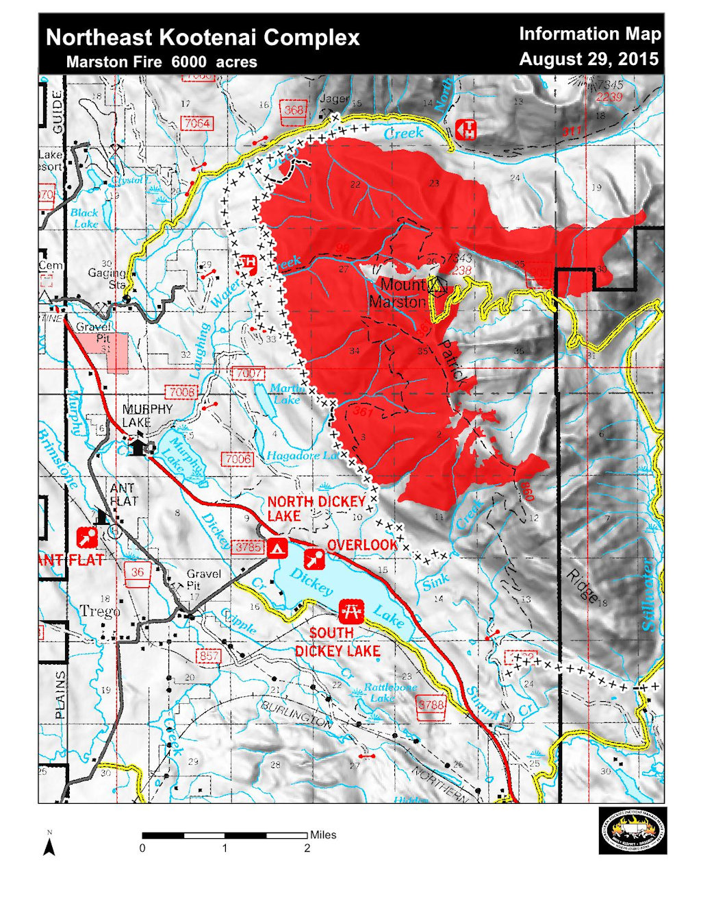
Also see the Northeast Kootenai Complex Proximity to Flathead NF Map for information on the position of the Marston Fire in relation to major North Fork features.
Information Officers: Katie Knotek, Tom Rhode & Meg Nemitz
Fire Information Line: (406) 882-8308
Office hours: 8:00 a.m. to 8:00 p.m.
Email: northeastkootenaicomplex@gmail.com
INCIDENT: Northeast Kootenai Complex (includes Barnaby, Marston, and Sunday Fires)
AGENCY JURISDICTION: USDA Forest Service, Kootenai & Flathead National Forests; Montana DNRC, Libby and Stillwater Units.
INCIDENT COMMANDER: Shawn Pearson, Northern Rockies Type II Incident Management Team (IMT). The Incident Command Post (ICP) is located at the Murphy Lake Ranger Station.
WEATHER & FIRE BEHAVIOR: Weather today will be mostly cloudy in the morning becoming partly sunny by the afternoon. Maximum temperatures will be in the low 70’s, relative humidity around 30%, and winds will be light from the southwest. Based on these conditions, moderate fire behavior is expected to continue. On the Marston Fire, fire will continue the slow process of backing downhill toward Deep Creek on the North and Sink Creek on the South.
MARSTON FIRE:
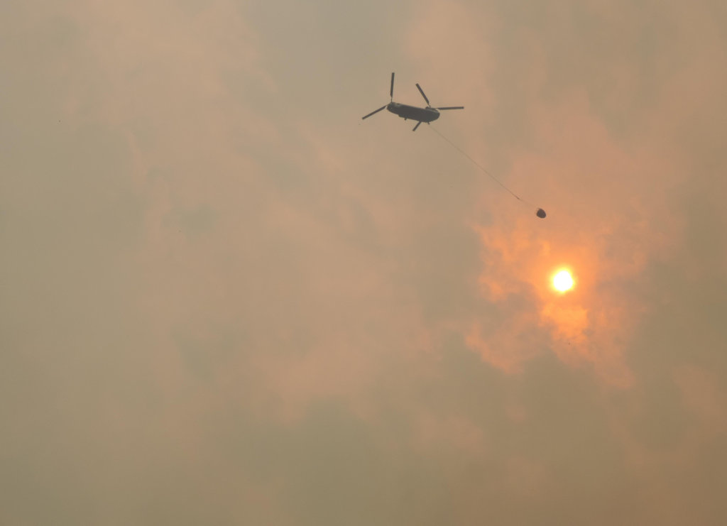
The Marston Fire is estimated at 6,700 acres with 20% containment. On the North side of the fire, crews are continuing to mop up and secure fireline in the bottom of Deep Creek and monitoring the fire backing down to the creek east of Jeager Mine. Nine miles of fireline, from Deep Creek south to about one mile above Sink Creek, continues to hold and is keeping the fire from moving west. Weather permitting, crews may conduct burnout operations between the indirect line and the fire perimeter south towards Sink Creek in order to increase the amount of secure fireline. Water drops from helicopters will be used to minimize fire movement as necessary. The fire has NOT moved onto the Flathead National Forest and is approximately 20 miles away from Polebridge.
SUNDAY FIRE:
The Sunday Fire located about four miles southeast of Stryker, MT, is 60 acres with 100% containment and is being patrolled daily to check for hotspots.
BARNABY FIRE:
The Barnaby Fire is located about four miles northeast of Eureka in steep, rugged terrain. Fire will continue to smolder but activity is diminished due to weather conditions. The fire is being monitored from the air with helicopters available to drop water as needed. Fire remains 50 acres, 0% containment.
PERSONNEL AND RESOURCES: 247 personnel including 2 Type -1 crews, 3 Type – 2 crews, 2 engines,
3 helicopters (2 Type – 1 Chinook, 1 Type – 2), 1 dozers, 2 water tenders, and 1 skidgine.
SPECIAL MESSAGES/CLOSURES: There are Area Closures on the Fortine Ranger District, Kootenai National Forest, for both the Martson and Barnaby Fires. The Martson Fire Area Closure includes closure of Murphy Lake for the safety of firefighting equipment and the public, as helicopters dip water out of the lake. There is an additional Area Closure for the Marston Fire on the Hungry Horse-Glacier View Ranger District, Flathead National Forest, should the fire move into the area. See Inciweb for maps and explanations of closures.
A Community Meeting will be held Wednesday, September 2, at 7:00 p.m. at the Trego Civic Center.
For more information on the fires, visit: http://inciweb.nwcg.gov/; Select “Northeast Kootenai Complex”