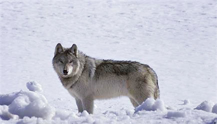
HELENA – Wolf numbers in Montana continue to be well above minimums outlined in the Montana Wolf Management Plan, and they are seeing a decline.
As part of the package released for public comment Friday, Montana Fish, Wildlife & Parks released its annual Wolf Report, along with proposed changes to the Wolf and Furbearer Trapping Regulations. These will be in front of the Fish and Wildlife Commission on Aug. 19 during their regular meeting.
This year’s Wolf Report contains two population estimates as FWP is moving toward an updated version of the wolf population estimation tool Integrated Patch Occupancy Model (iPOM). The new version, iPOM 2.0, is yet to be published in a peer reviewed scientific journal, like iPOM.
Under iPOM, the wolf population is estimated to be relatively stable at 1,094 wolves. With iPOM 2.0, the population estimate is lower at 725 wolves.
In developing iPOM 2.0, Montana researchers were able to incorporate much of the wolf data and research they have collected over the past several years. This Montana-specific data, particularly on pack sizes and distribution, provides a more accurate estimate, said Quentin Kujala, FWP Chief of Conservation Policy.
“We’re confident in iPOM 2.0 and see it as an advancement in science and modeling,” Kujala said. “However, it hasn’t been through the same peer-review process as the original iPOM. Until that happens, we want the Commission and the public to see estimates from both models.”
By using iPOM 2.0 to analyze wolf population estimates from past years, it shows a steady decline in wolf numbers from 2021. As a result, FWP is recommending a reduction to the 2026/2027 wolf harvest quota to 250. This is down from a quota of 450 last year. Last year 247 wolves were harvested.
The Montana Wolf Management Plan outlines 450 wolves as the minimum number necessary to ensure there are 15 breeding pairs in the state. These are minimum numbers and not a management objective for FWP.
At the Aug. 19 Fish and Wildlife Commission meeting, the commission will consider the wolf and furbearer trapping regulation proposal from FWP. Included in that proposal is the annual wolf harvest quota. The public can comment on the proposal through Aug. 12.
Commissioners can propose amendments to FWP’s proposals and those amendments will be available for public comment if possible. Commissioners can also propose amendments or other proposals at the commission meeting.
The public can comment on commission items in advance, as well as during the meeting by attending in person or virtual via Zoom. The public can attend in person at the Montana Heritage Center or at one of FWP regional offices. The meeting will start 8 a.m. Aug. 19. If you want to attend virtually, you must register online between Aug. 4 and 12 p.m. Aug. 18.
Sally Thompson’s book reading and signing event highlighting her latest work Disturbing the Sleeping Buffalo and originally scheduled for this Saturday, June 27th, has been canceled due to a crummy weather forecast.
There is a petition before the Flathead County Planning Office to amend our North Fork Neighborhood Plan zoning regulations. If passed this would provide definitions for “public” and “private” roads, excluding the North Fork and Forest Service roads, and reduce their setbacks from the current 100ft to 20ft and 10ft respectively. If passed, the implications are unclear, although they may have impacts in certain areas.
There is a meeting with the North Fork Land Use Advisory Committee and county planning staff Thursday June 25th at 4:00pm at Sondreson Hall that will enable the public to both gain insight into the proposed amendment and provide an opportunity to state your opinion on the official record. Zoom participation will be available. If you would like additional information, please contact me at kenyonnorthfork@gmail.com or 406-890-4460.
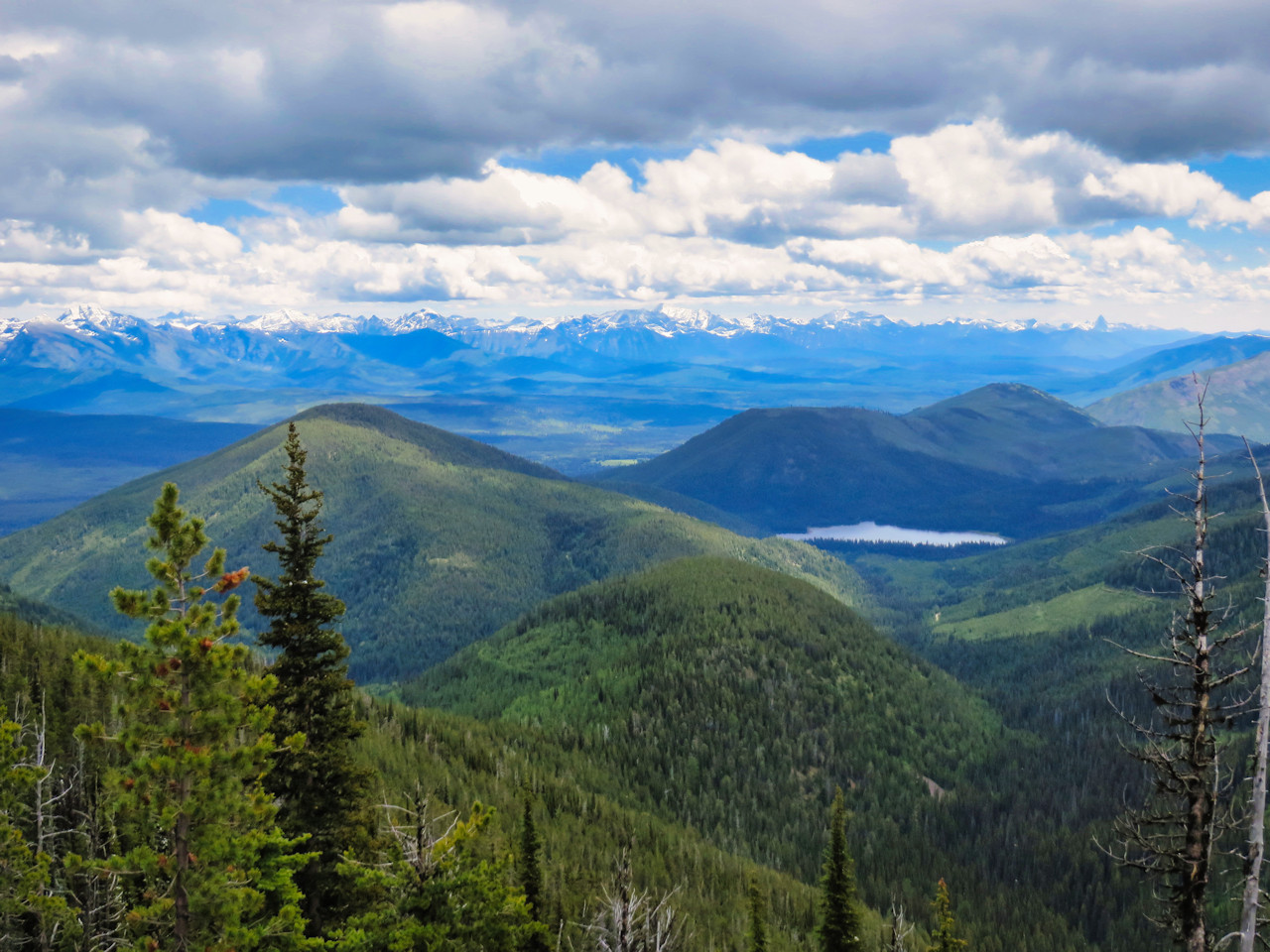
Several types of public lands: Flathead National Forest is in the foreground, left and right; Montana’s Coal Creek State Forest, including Cyclone Lake, is in the middle distance; Glacier National Park stretches across the background.
Founding NFPA member Frank Vitale gets some virtual ink with this well thought out opinion piece appearing in several newspapers, including the Flathead Beacon . . .
It was early summer in 1992, in the northern Whitefish Range. Four riders were moving slowly along the narrow rocky ridge on Trail #114 to where it joined Trail #19, and eventually up to the top of Tuchuck Mountain. I was told that the name “Tuchuck” in the Kootenai language means “the thumb.”
It was a beautiful sunny day with a light westerly breeze. Wildflowers were in full view everywhere. Some of the open subalpine slopes looked as if they were rototilled with clumps of dirt overturned and rocks strewn everywhere. Obviously, grizzly bears were working over the slopes and digging up the succulent roots of glacier lilies, biscuitroot, sweet vetch and other favorite plants in these subalpine meadows.
I was one of those four riders, trailing one of my young mules. I’d ridden and hiked this trail many times before, and in some hunting seasons, packed out elk. I know this country well. Although it’s been a number of years since I led a packstring up into the northern Whitefish Range, I remember the view from our vantage point on that day. Looking east, from north to south, one could view the start of the Canadian Rockies clear over to the high peaks in southern Alberta, and the whole western expanse of Glacier National Park clear down to the Great Bear Wilderness and the Middle Fork of the Flathead River.
Looking northwest, one could see clear into the rugged peaks of southeastern British Columbia, and south all the way down to the Cabinet Mountain Wilderness and beyond.
I reflect back on my many years and many miles in the saddle leading a packstring of mules across some of the wildest country left in the Northern Rockies. This includes the Bob Marshall Wilderness, Badger-Two Medicine, Rocky Mountain Front, Scapegoat, Great Bear, wild Swan, and the Whitefish Range. This country has been the center of my universe for nearly 50 years.
Fast forward to September 2012. A diverse group of folks from different backgrounds, viewpoints and interests were invited to sit down and form a citizen’s advisory to help the Flathead National Forest update and revise a portion of their new management plan for the Whitefish Mountain Range on the Glacier View Ranger District. That group, in which I was asked to participate, was officially named the Whitefish Range Partnership Agreement. A total of 30 people made up this collaborative. They represented motorized recreation, mountain biking, hiking, landowners, business owners, Confederated Salish and Kootenai Tribes, Montana Logging Association, Stoltz Lumber, wildlife organizations, Backcountry Horsemen, hunting and fishing groups and wilderness organizations.
The Forest Service provided the framework in which we could work, and they gave us the support, expertise, and encouragement to see this collaborative succeed. This dedicated bunch of people stayed together until the collaborative reached consensus in 2018. Remarkably, the Forest Service adopted nearly 95 percent of what the group recommended to incorporate into the new Forest Plan Revision.
The partnership had its ups and downs and disagreements, but in the end, everyone walked away feeling good about what could be accomplished when people sit down, roll up their sleeves, and have meaningful conversations on what’s important.
For me, it was folks who ordinarily would have never supported wilderness in the North Fork, but in the end came together to support protection in some of the last unroaded wildlands left in the Whitefish Range.
So fast forward to 2026. Recently, the Senate Energy Natural Resource Committee (SENRC) voted on S140 – the Wildfire Protection Act of 2025. Attached to this bill is a provision to repeal the Roadless Rule, the very rule that protected the North Fork proposed wilderness that the Whitefish Range Partnership worked so hard and for so long to reach a consensus.
Do you remember a senator from Utah by name of Mike Lee? He chairs the SENRC, and just last year he introduced a bill to sell off large swaths of our public lands. Another name to remember is Steve Daines, one of Montana’s senators who has been trying for years to undo protections for some of our wildest landscapes in Montana. Every Republican on the SENRC voted to repeal a landmark decision created back in 2001, that had remarkable bipartisan support with the vast majority of Americans supporting it.
When the Roadless Rule was first developed, it was the most extensive public engagement process in the history on management of public lands in the United States. When talk of a possible recission of the Roadless Rule was being announced by the Trump Administration, nearly 99 percent of the comments were in favor of keeping the Roadless Rule intact.
Steve Daines and Mike Lee are clearly out of step on this issue. Some of our best unprotected wild country could very well be on the chopping block. This includes places like the North Fork Wildlands, Badger-Two Medicine, wild Swan Range, and the Rocky Mountain Front.
These wildlands are the source of our clean water, clean air, abundant fish and wildlife. They’re a place where we can experience wild nature and they make us better people.
For me, the seeds of conservation and the love of wild nature were sown as a young boy with pant legs rolled up, with fishing pole in hand, wading clear mountain streams catching wild brookies.
I’d like to end with a quote from Aldo Leopold’s memoir, A Sand County Almanac:
“To those devoid of imagination, a blank place on the map is a useless waste; to others, the most valuable part.”
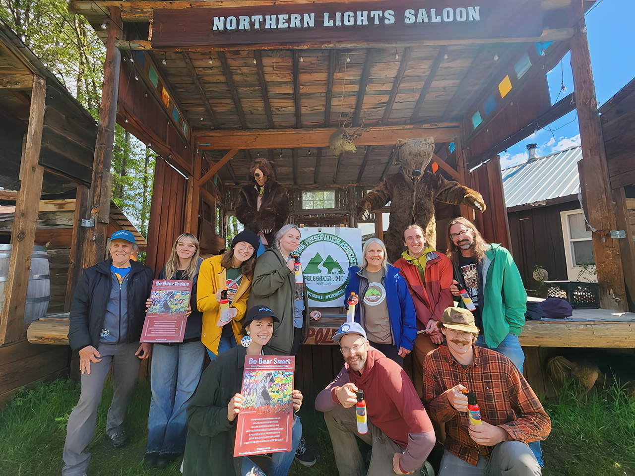
Polebridge Bear Smart trainig session, June 4, 2026
Polebridge Bear Smart had the first of two trainings for seasonal workers in Polebridge. This was held on the morning of June 4th at the Northern Lights Saloon. The second training will be held June 30th at the Polebridge Mercantile. What a great group of folks and the bears were pretty well behaved as well.
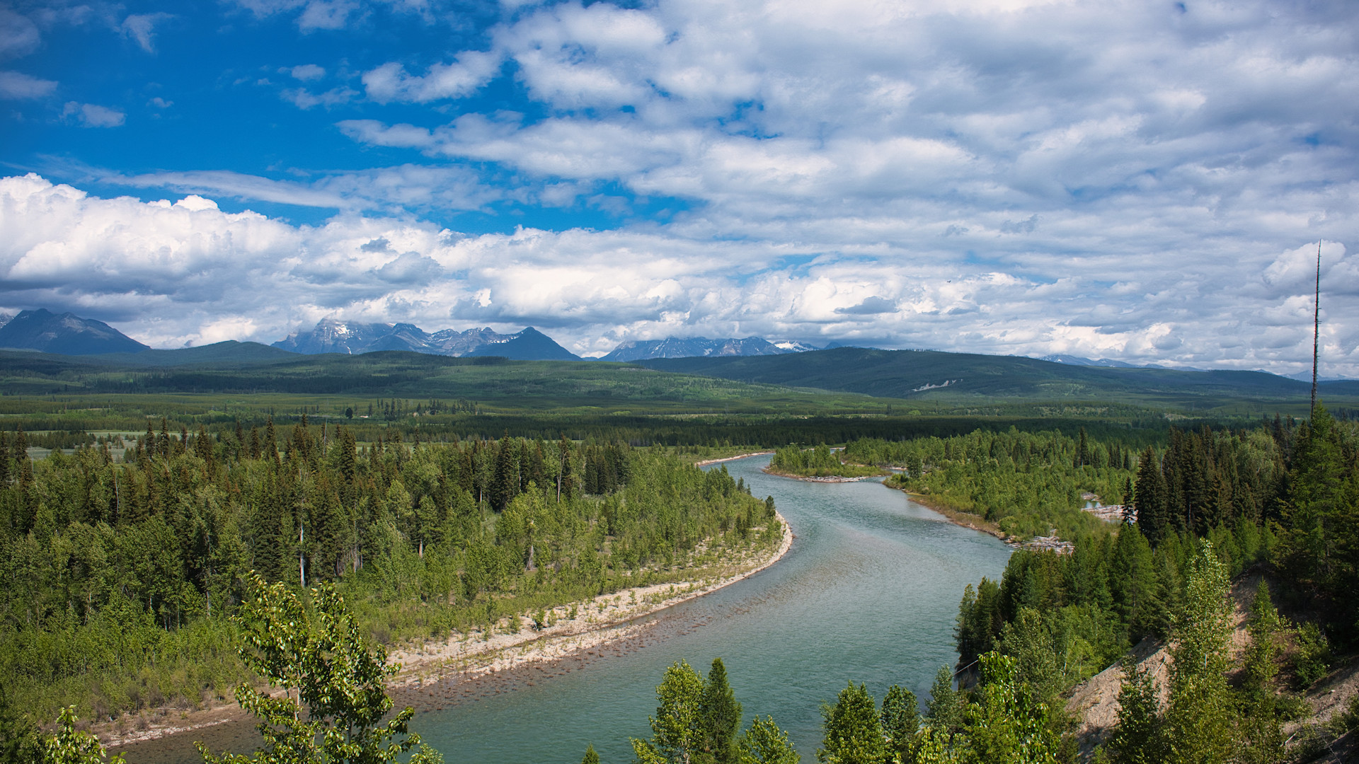
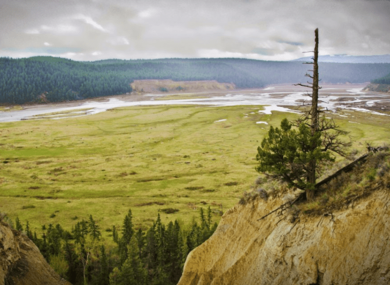
North Fork of the Flathead River, May 28, 2023 – W. K. Walker
Here’s an excellent article by Maggie Dresser for Flathead Living about the intertwined history of the Three Forks of the Flathead River and the creation of the Wild and Scenic Rivers Act . . .
On Oct. 23, 1956, a crew of geologists and specialized equipment operators traveled five miles south of U.S. Highway 2 from the Bear Creek confluence along the upper Middle Fork Flathead River where they drilled four test holes roughly 150 feet into the sedimentary argillite. Situated just above a two-mile series of whitewater rapids known as Spruce Park, in what is now the Great Bear Wilderness, Bureau of Reclamation geologist Rondo Birch described the Precambrian bedrock as “excellent,” according to newspaper archives.
For six weeks, a team of geologists and engineers with the Bureau of Reclamation conducted field studies on the feasibility of a diversion project for the proposed Spruce Park dam, a 405-foot-tall earth-filled structure that would back 360,000 acre-feet of water with a 2,760-acre reservoir, the size of Wild Horse Island on Flathead Lake. A 38,000-foot-long transmountain pressure tunnel would be excavated to divert flood waters to Hungry Horse Reservoir, where a 21,000-kilowatt powerplant would be constructed on the South Fork Flathead River near Hoke Creek. The additional water would add a surplus of hydropower to the Hungry Horse dam, an infrastructure project that had been completed three years earlier.
The Spruce Park dam proposal was officially introduced in June of 1957 and would take center stage at public meetings on-and-off for the next two decades. Proponents of the dam saw economic prosperity associated with the project, bringing in “construction payrolls” for residents of Columbia Falls, Hungry Horse and Martin City.
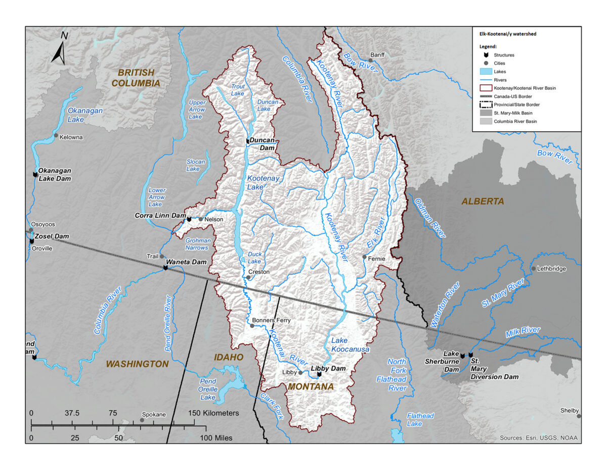
Map of the Elk and Kootenai River watershed spanning the border of British Columbia, Montana and Idaho – courtesy of the International Joint Commission
Here’s an excellent, well-researched article by Tristan Scott of the Flathead Beacon on the continuing effort to deal with selenium pollution in the trans-boundary Elk-Kootenai watershed. Recommended reading . . .
Tribal governments from Montana, Idaho and British Columbia (B.C.) are closing ranks to oppose a coal mine expansion project in the shared Kootenai River watershed, describing a proposal to build out the mine’s footprint as short-sighted in light of an ongoing international inquiry into a cross-border pollution problem that has persisted for decades.
The league of Indigenous leaders includes western Montana’s Confederated Salish and Kootenai Tribes (CSKT), whose council last month called on B.C.’s provincial government to suspend its review of the project “until sufficient mitigations are in place to address the historical loads of mine-sourced contaminants in the watershed,” including selenium and nitrates — mining toxins that originate in B.C.’s Elk Valley mines and persist all the way to the confluence of the Kootenai watershed with the Columbia River.
On Thursday, CSKT’s council submitted a formal request to Canada’s Minister of Environment and Climate Change Julie Dabrusin, asking that an independent review panel convene to “more robustly analyze” the Fording River Extension (FRX) coal strip mine project “and its implications for both Canada and the United States.” The governments of the Kootenai Tribes of Idaho and the Ktunaxa Nation in Canada have also called the project’s review phase premature and were expected to sign on to the request for independent oversight.
Elk River Valley near Fernie, British Columbia, as it flows into Lake Koocanusa – Terry Lawson, via Flickr
Our friends to the west in the Elk-Kootenai watershed just won and important victory . . .
A long-running dispute over a Montana water-quality standard that involves a Canadian coal mine, a border-straddling waterway, and a suite of local, state and federal officials drew to a close this week.
Montana District Court Judge Kathy Seeley ruled on April 8 that the selenium standard the Montana Department of Environmental Quality adopted for Lake Koocanusa in 2020 can stand. The Lake Koocanusa standard, which involved an extensive scientific and rulemaking process, is 0.8 micrograms per liter.
Selenium, a chemical element that’s toxic to fish above certain thresholds, has been accumulating in the Kootenai River watershed for decades as a result of a massive coal-mining operation in British Columbia. Precipitation releases the selenium that naturally occurs in mine waste, and treatment technologies have demonstrated limited success for removing it.
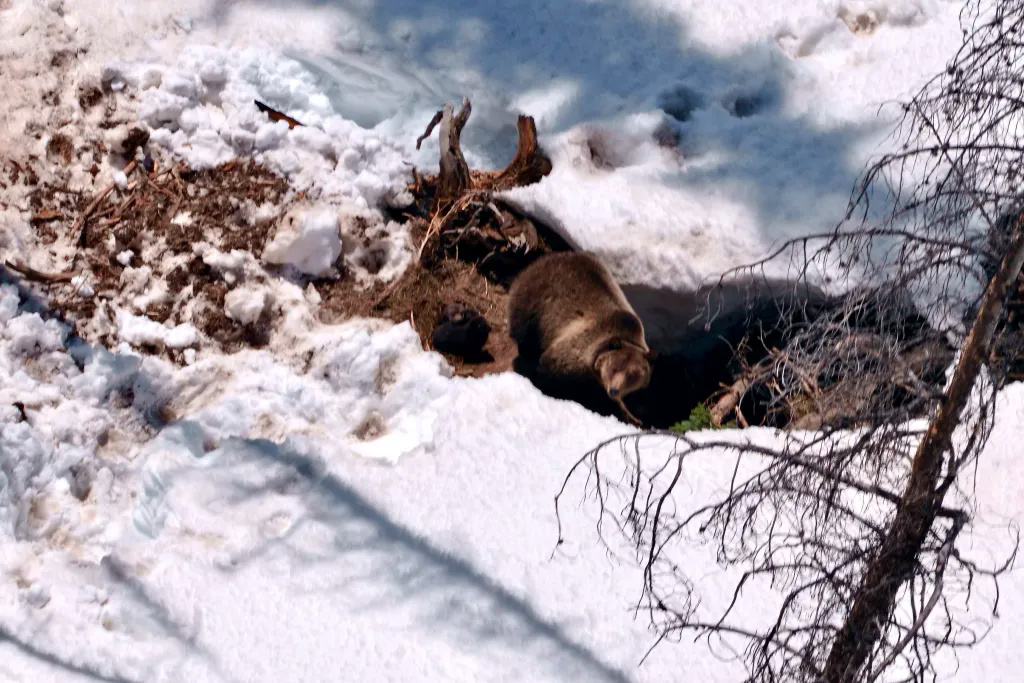
Grizzly sow 1126F appears outside her den on March 27 in the Teton Wilderness with two cubs of the year on the ground to her left – Wyoming Game and Fish
Here’s another great article by Rob Chaney . . .
Greater Yellowstone’s grizzly bear population has grown by at least two this spring.
Federal and state biologists count grizzlies every year, although they don’t usually get this granular. But when a Wyoming Game and Fish wildlife monitoring flight on March 27 brought back the photo of Grizzly 1126F outside her Teton Wilderness hibernation den with two cubs clearly tussling beside her, the discovery checked some special scientific and legal boxes.
“She’s clearly in great shape, for a young mother coming out of the den,” said Quentin Kujala, Montana Fish, Wildlife and Parks Chief of Conservation Policy. “That’s the gold standard to the point of cub production.”
North Fork of the Flathead River, May 28, 2023 – W. K. Walker
After years of efforts and false starts, the Flathead National Forest has released a draft Comprehensive River Management Plan (CRMP). Here are the high points of immediate concern . . .
Two public information sessions will be held at Flathead Valley Community College on February 17 and 18, from 6 to 8pm at the Arts and Technology building, room 139 (AT-139). Both sessions will be open-house format, with information stations staffed by members of the project team.
Kalispell, Mont., February 10, 2026 — The Flathead National Forest has released a draft Comprehensive River Management Plan for the three forks of the Flathead Wild and Scenic River and associated draft environmental assessment of the plan. Both draft documents are available for public review on the project webpage: https://www.fs.usda.gov/r01/flathead/projects/56536
The draft Flathead Comprehensive River Management Plan and associated draft environmental analysis outline the existing condition of the three forks of the Flathead River; identify the outstandingly remarkable values and desired conditions; and identify user capacities and articulate management actions that would be taken to protect these values into the future. The draft also contains a monitoring plan designed to gather real-time data on river use, track long-term trends and assess the effectiveness of management actions.
The draft plan incorporates changes that have occurred since the Wild and Scenic designation, including visitor use patterns, environmental conditions, Endangered Species Act species listing and other laws that affect resources within the Wild and Scenic River corridor.
“We have a high level of river recreation from all over the country and the world. All three forks are highly sought after for recreation opportunities, and this draft plan is an important step towards long-term river management and protection of this world-class resource” said Rob Davies, district ranger for the Hungry Horse and Glacier View Ranger Districts. “The 1980 plan is past due for an update, and the Flathead National Forest has been deeply engaged in this multi-agency project. We’re grateful for the involvement and collaboration from Glacier National Park, U.S. Fish and Wildlife Service, Montana Fish, Wildlife & Parks, community members, nonprofit organizations, and our outfitter and guiding partners who have all contributed to the development of this draft plan.”
“This project has received a high level of public and stakeholder investment from the start, and the demand for protection of the outstandingly remarkable values found on these river segments has driven the development of the draft plan” said Anthony Botello, Flathead National Forest supervisor. “We are all eagerly waiting for this river plan. The passion and support that exists for the three forks of the Flathead and the protection of the Wild and Scenic River is inspiring. We are privileged to steward and protect the three forks of the Flathead.”
Wild and Scenic River management plans protect and enhance the outstandingly remarkable values identified in Wild and Scenic designations. The draft Comprehensive River Management Plan revises the existing 1980 river management plan and brings it into compliance with the statutory requirements of the Wild and Scenic Rivers Act. The final Comprehensive River Management Plan is expected to be released in summer of 2026, accompanied by the final environmental analysis document.
Two opportunities to join us for a project information session:
6 – 8pm on Tuesday Feb. 17
6 – 8pm on Wednesday Feb. 18
Both information sessions will be open-house format at Flathead Valley Community College, Arts and Technology building, room 139 (AT-139), with information stations staffed by members of the project team.
Flathead National Forest and Glacier National Park will provide information on the draft Comprehensive River Management Plan and will be available to answer specific questions. The sessions will start with a brief presentation with an option for virtual attendance. Link to attend virtually will be made available under Project Documents on the project website.
How to submit comments on the project:
This public comment period will be open for 30 days, concluding March 13, 2026. Comments and attachments may be submitted electronically at https://cara.fs2c.usda.gov/Public/CommentInput?project=56536.
Written comments may be mailed, or hand-delivered Monday through Friday, 8 a.m. to 4:30 p.m., excluding holidays, to the Hungry Horse-Glacier View Ranger Station (P.O. Box 190340, 10 Hungry Horse Drive, Hungry Horse, MT, 59919) or to the Forest Supervisors Office, (650 Wolf Pack Way, Kalispell, MT 59901).
Additional information can be found at: https://www.fs.usda.gov/r01/flathead/projects/56536