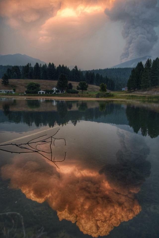
Here’s this morning’s report on the Northeast Kootenai Complex fires. Of greatest interest to North Forkers is the Marston Fire, which made a run to the northeast over the last couple of days, resulting in a precautionary closure of a section of the Flathead National Forest in the North Fork.
Information Officers: Katie Knotek, Tom Rhode & Meg Nemitz
Fire Information Line: (406) 882-8308
Office hours: 8:00 a.m. to 8:00 p.m.
Email: northeastkootenaicomplex@gmail.com
INCIDENT: Northeast Kootenai Complex (includes Barnaby, Marston, and Sunday Fires)
AGENCY JURISDICTION: USDA Forest Service, Kootenai & Flathead National Forests; Montana DNRC, Libby and Stillwater Units.
INCIDENT COMMANDER: Shawn Pearson, Northern Rockies Type II Incident Management Team (IMT). The Incident Command Post (ICP) is located at the Murphy Lake Ranger Station.
WEATHER & FIRE BEHAVIOR: A red flag warning has been issued for today. Temperature will be in the low 80s today with relative humidity in the low 20s. Winds will be from the south, switching to southwest and west, with an increase throughout the day peaking in late afternoon or early evening with the passage of a cold front. The winds will override the cooler temperatures and higher relative humidity with fire activity increasing throughout the day.
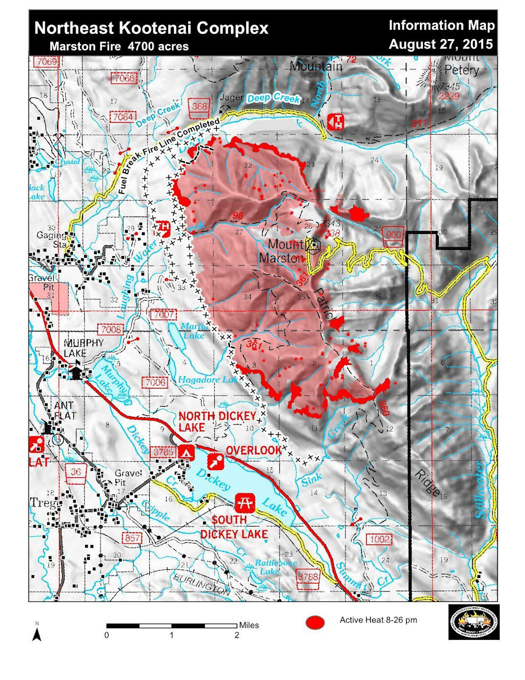
MARSTON FIRE:
The Marston Fire is estimated at 6,000 acres with 10% containment. The fire increased over the last couple of days due to fire growth on the northeast side of the fire. Equipment and crews continue to mop up and secure line on the northern, west and southwestern edges of the fire. In addition, fuel breaks are being constructed south of the fire and east onto the Stillwater State Forest. Helicopter bucket drops are used daily, as air/smoke conditions allow, in an effort to slow fire growth.
SUNDAY FIRE:
The Sunday Fire located about four miles southeast of Stryker, MT, is 60 acres with 100% containment. Palm IR (Infrared) was used yesterday by local Forest Service personnel to try and detect any remaining hot spots on the fire and will be used again today.
BARNABY FIRE:
The Barnaby Fire is located about four miles northeast of Eureka in steep, rugged terrain. The fire is being monitored from the air. Water was dropped from the chinook helicopters on the fire late yesterday to keep the fire in check. Fire remains 50 acres, 0% containment.
PERSONNEL AND RESOURCES: 343 personnel including 2 Type -1 crews, 4 Type – 2 crews, 10 engines,
3 helicopters (2 Type – 1 Chinooks, 1 Type – 2), 7 dozers, 9 water tenders, and 4 skidlines.
SPECIAL MESSAGES/CLOSURES: There is an area closure for both the Martson and Barnaby Fires. The Martson Fire Closure includes closure of Murphy Lake for the safety of both firefighting equipment and the public, as helicopters dip out of Murphy Lake for water drops on the Marston Fire. A new Area Closure for Hungry Horse Ranger District, Flathead National Forest has been issued. See Inciweb for maps and explanations of closures.
The Incident Management Team will have a booth at the Lincoln County Fair this weekend. A community meeting will be held Sunday evening, August 30, at 7:00 p.m. at the Trego Civic Center.
For more information on the fires, visit: http://inciweb.nwcg.gov/; Select “Northeast Kootenai Complex.”