Category Archives: Documents

U.S. Forest Service releases Region 1 annual report

The U.S. Forest Service has released its annual report for the Northern Region (Region1). It’s available online for viewing and downloading . . .

The U.S. Forest Service has published its Year in Review report for the Northern Region across northern Idaho, Montana and North Dakota and northwestern South Dakota in 2012.

The Northern Region, or Region 1 as the agency designates it, is comprised of 13 forests and grasslands, and manages more than 25 million acres of public lands that include wilderness areas, wild and scenic river corridors, plus many other recreational opportunities.

The report offers a recap of projects and efforts from the past year, including the historic fire season and the biomass research conducted by F.H. Stoltze Land and Lumber in Columbia Falls.

Continue reading . . .

Direct link: USFS Region 1 Annual Report

“The North Fork: Living with Wildlife” pamphlet available online

Newly available in digital form . . .

“The North Fork: Living with Wildlife” is a joint NFLA/NFPA publication that outlines recommendations on how to live responsibly in wildlife habitat and suggests specific ways to minimize the chances of conflict with such animals as grizzly bears, black bears, mountain lions, wolves, coyotes, deer, elk and moose. This is an excellent brochure for new and current landowners alike. It also includes some wonderful illustrations by Diane Boyd.

This brochure is available at the NFLA web site or you can download it right here (PDF format). It also has a permanent home in our archives. Please feel free to reproduce and distribute as often as you like.

Summer 2011 NFPA newsletter now available online

For those of you who can’t wait on the mail, the North Fork Preservation Association Summer 2011 Newsletter is now available online in the Newsletters section of the website. Enjoy!

Here’s a partial table of contents:

  • Completing the “Gentleman’s Agreement” in the Trans-boundary Flathead – John Frederick
  • U.S.-Canadian “Gentleman’s Agreement” To Protect Montana River – from New West
  • Exxon Megaloads and the North Fork – editorial by Paul Edwards
  • NFPA Annual Meeting Features Bylaw Changes, Well-Known Speaker
  • Don’t Feed the Bears; Do Feed the Web Site

Full text: Letter urging passage of enhanced protections for Waterton-Glacier Park

(Note: This is the full text of a public letter signed by six former superintendents of Waterton and Glacier Parks encouraging the U.S. and Canadian governments to complete passage of legislation intended to enhance protections for the parks, including the U.S. North Flathead Protection Act currently stuck in a year-end Senate logjam.)

One hundred years ago the United States followed Canadaʼs leadership in protecting the core of the Crown of the Continent ecosystem, establishing Glacier National Park in Montana as a southern sister to Albertaʼs Waterton Lakes National Park. Waterton-Glacier International Peace Park is located where the Rocky Mountains tie our two countries into one landscape. As one of North Americaʼs most spectacular mountain parks, it is a source not only of inspiration and recreation, but also abundant clean water for communities from Hudson Bay to the Gulf of Mexico.

The combined parks encompass a protected topography of 1.1 million acres (450,000 hectares) that has gifted generations with an inheritance beyond measure. Today, more than 2 million people from around the world travel to Waterton-Glacier annually to experience the alpine majesty of the worldʼs first international peace park.

Throughout this past century, Canada and the United States have taken significant steps to protect and preserve this international treasure, including bilateral support for designating the Peace Park a World Heritage site in 1995. Early in this centennial birthday year, both countries furthered a decades-old international effort to safeguard Waterton-Glacierʼs pristine headwaters, by protecting British Columbiaʼs remote Flathead River Valley and Montanaʼs North Fork Flathead River drainage from proposed coal strip-mining, coalbed methane extraction, and gold mines.

The steps taken to date — which include retiring more than 200,000 acres (80,000 hectares) of oil and gas leases in the Montana North Fork, and a mining ban in the B.C. portion of the watershed — are historic and worthy of recognition. However, there remains unfinished work to ensure the legacy of Waterton-Glacier.

Nearly six months ago, on the margins of the G-20 Summit in Toronto, the offices of the Prime Minister and President issued a joint statement pledging federal action toward the sustained protection of Waterton-Glacierʼs transboundary headwaters. This commitment will build upon an agreement between the province of British Columbia and state of Montana — signed during the 2010 Vancouver Winter Olympics — to enhance environmental protection and cooperation throughout the Crown of the Continent region. Today, however, the federal-to-federal agreement that will complete this state/provincial effort has yet to be accomplished.

In Canada, a long-standing proposal to complete the Peace Park by expanding Waterton Lakes National Park into one-third of British Columbiaʼs Flathead Valley remains under government review, despite strong public support at the local, regional and national levels. And earlier this year, the UNESCO World Heritage Committee urged Canada to “develop a pro-active plan for enhancing wildlife connectivity” between Waterton-Glacier and Banff National Park, a step that remains incomplete.

Work also remains unfinished in Washington, D.C. Despite passing the U.S. Senate Natural Resources Committee nearly eight months ago, the bipartisan North Fork Protection Act has yet to be acted upon by the full Senate.

This vital legislation would prohibit new mining and fossil fuel leasing on Waterton-Glacierʼs western periphery, in high mountain country that includes the drinking water supply for the gateway community of Whitefish, Montana. The bill also protects lands throughout the Middle Fork of the Flathead River corridor, a Congressionally designated Wild and Scenic River that forms Glacier Parkʼs southwestern boundary. The measure enjoys tremendous local support, and represents a long-term and tangible gift for Glacier on its 100th birthday.

Today, however, this legislation remains stalled in the U.S. Congress. And without immediate action, this valuable and worthy endowment to future park visitors will be forced to begin the political process anew in 2011.

If we have learned one thing during these past 100 years, it is that international cooperation is a requisite to protecting a peace park that transcends boundaries. We urge leaders in both countries to ensure Waterton-Glacierʼs continued legacy through the prompt consideration and passage of these measures.

Word Count: 621

Contact Mick Holm: 406-756-9055 or mpholm@centurytel.net

Waterton Lakes Signatories
Merv Syroteuk, Creston, BC (1992-1996)
Peter Lamb, Lethbridge, AB (1999-2004)

Glacier National Park Signatories
Mick Holm, Columbia Falls, MT (2002-2008)
Dave A. Mihalic, Missoula, MT (1994-1999)
Gil Lusk, Green Valley, AZ (1986-1994)
Bob Haraden, Bozeman, MT (1980-1986)
Phil Iverson, Lakeside, MT (1974-80)
Bill J. Briggle, South Beach, OR (1969-1974)
UNESCO World Heritage Committee report recommends increased Flathead Valley protection

The UNESCO World Heritage Committee released the final report of the scientific mission study of threats to Waterton-Glacier Park. A press release posted to the Flathead Wild website has the highlights . . .

A report commissioned by the UNESCO World Heritage Committee is calling for a “conservation and wildlife management plan” for the transboundary Flathead and a new management plan for the Flathead River Valley that “gives priority to natural ecological values and wildlife conservation.”…

The 50-page report, released today at the World Heritage Committee meeting in Brasilia, recommends:

  • A new B.C. Southern Rocky Mountains Management Plan “that gives priority to natural ecological values and wildlife conservation.”
  • Taking steps to minimize barriers to wildlife connectivity, including a long-term moratorium on further mining developments in south eastern B.C., including in the Elk Valley, “in the corridor of natural terrain that creates vital habitat connectivity and allows the unimpeded movement of carnivores and ungulates” between Waterton-Glacier and Canada’s Rocky Mountains national parks.
  • A single conservation and wildlife management plan for the transboundary Flathead.
  • Inscription of Waterton-Glacier on the list of World Heritage in Danger if development of the proposed Lodgepole coal strip mine had proceeded (the B.C. government banned Flathead mining and energy development in February 2010 after receiving a draft copy of the mission report).

For those of you who prefer to get your information directly from source documents, we’ve made the full report available for direct viewing/download (50 pages, PDF format, 2MB).

Draft North Fork Road corridor study document is now available; meeting on July 27th

According to an email sent out yesterday afternoon by Pam Murray of PB Americas, the draft North Fork Road corridor study document is now available online and, for those of you traveling down-valley, on paper. (If you came late to the party, the corridor study is a $125K project looking at alternatives for improving the condition of the North Fork Road from Blankenship Road to Camas Junction.)

Ms. Murray said,

The draft corridor study document is now available for your review, please visit the website: http://www.mdt.mt.gov/pubinvolve/northfork/documents.shtml and if the link does not work you can find the document by going to the study webpage at http://www.mdt.mt.gov/pubinvolve/northfork/ From the menu on the left go to “documents” and then clicking section by section on the draft document.

The whole document is available as one file, however it is a very large file (over 20 M) and will probably time out for most people before the download is complete.

Paper copies of the draft corridor study document are also available at these locations:

  • The Columbia Falls Library, 130 6th  Street West
  • Flathead County Offices, 800 South Main Street, Kalispell
  • MDT Office, 85 5th Ave East North, Kalispell

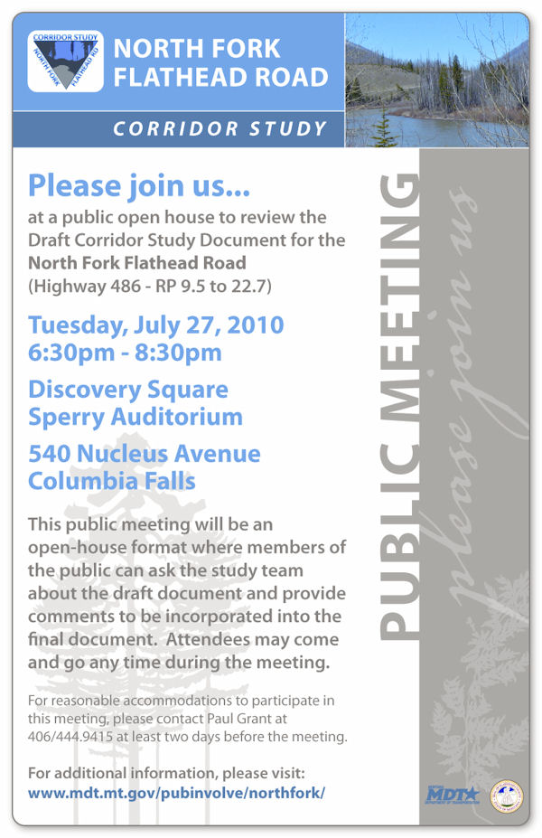
Please review the draft corridor study document.  We also invite you to attend the public meeting on July 27, 2010 at Discovery Square, Sperry Auditorium anytime between 6:30 pm and 8:30 pm…

The purpose of the public meeting is to receive your comments on the draft corridor study document.  If you are unable to attend the meeting next week you can provide us comments on the draft corridor study document using the “comment on this study” link from the study webpage (see above link).

Additional information…

The entire current set of documents discussing the corridor study includes:

The following poster includes more information about the meeting on July 27th. Note this little item near the bottom: “For reasonable accommodations to participate in the meeting, please contact Paul Grant at 406/444.9415 at least two days before the meeting.” In other words, if you want to get up and say something, call ahead.

Corridor Study Announcement

Full text of proposed “Forest Jobs and Recreation Act” available

For those of you who prefer your information raw and unfiltered, this page has links to the full text of Sen Jon Tester’s proposed “Forest Jobs and Recreation Act” and to the associated “Proposed Land Designations” map: http://tester.senate.gov/Legislation/forestresources.cfm.

A comfortable chair and beverage of choice recommended prior to reading.

Tester’s forest plan gets the big reveal

The Missoulian is all over Senator Jon Tester’s “Forest Jobs and Recreation Act” (mostly called “Tester’s wilderness bill” throughout the week). The big reveal was at a meeting in Townsend Friday afternoon. The Missoulian posted a basic write-up shortly thereafter, followed by two lengthier articles early Saturday morning.

What’s the North Fork connection? The projects in the bill are the thin edge of the wedge. Tester is proposing a fairly basic change in the way the Forest Service works with all local communities.

Here are the links and ledes for the two most recent Missoulian articles, as well as a map showing the areas affected.

The smell of sawdust hung in the air Friday as U.S. Sen. Jon Tester stood in front of a small lumber mill and announced his plans to create almost 700,000 acres of new Montana wilderness, designate a new national recreation area and mandate timber harvests on thousands of forested acres.

Called the Forest Jobs and Recreation Act, Tester’s bill is the first effort to set aside new wilderness in Montana in a generation. Most of the new wilderness, more than 500,000 acres, would be in the Beaverhead-Deerlodge National Forest.

Yet most of the talk Friday was about all the other things Tester’s bill would do, specifically requiring timber harvests, directing different kinds of timber removal — like cutting small trees for biomass generators — and creating new kinds of contracts timber companies could make with the federal government.

Read the entire article . . .

Public lands logging would see big changes if U.S. Sen. Jon Tester’s Forest Jobs and Recreation Act becomes law.

That’s either a needed compromise to break deadlocks in Montana’s wilderness debate, or a step toward breaking up the U.S. Forest Service, depending on whom you talk to.

Read the entire article . . .

And also: A map of the proposed land designations in PDF format.

Road paving & land development report released

One of the factors in the ongoing road maintenance debate is the impact of paving on increased land development and settlement. Headwaters Economics along with Chris Servheen of the U.S. Fish and Wildlife Service and the University of Montana just released a report titled “Land Use Effects of Paving Rural Roads in Western Montana” that is relevant to this issue. In Chris’s words…

Headwaters Economics and I have partnered to complete a preliminary analysis of the relationship between the paving of rural roads and the development of adjacent private lands.  The report on this work is attached.  We believe this is a useful preliminary analysis and that it sets the stage for a more in-depth and through analysis of this most important issue.  The paving of rural roads in the West and the resulting impacts on adjacent private land development are one of the greatest challenges faced by wildlife managers and county decision-makers.  We hope this report is of value to you.

The report is essentially a series of case studies followed by some carefully qualified observations and conclusions. It’s a bit dry and dusty (sorry, couldn’t resist) in spots, but a worthwhile read.