Here’s the morning update for the Thompson-Divide Complex fires, including the Granite, Sheep and Thompson fires. Things are really winding down. This is the last regular update . . .
This is the Final Fact Sheet for the Thompson-Divide Complex from Northern Rockies Type II Incident Management Team Leach. Link to http://inciweb.nwcg.gov/incident/4468/
Fire Complex Completed: 72% Injuries: 1 Structures Lost: None
Resources – Total Personnel: 87 Engines: 2
Cause of Fires: All three fires have been determined to be lightning caused.
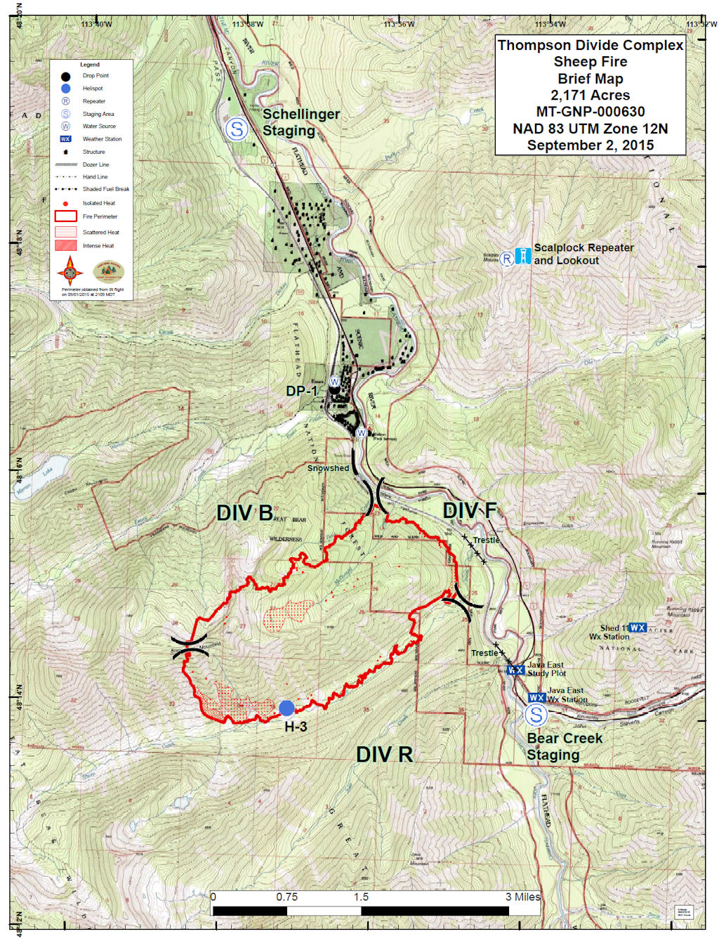
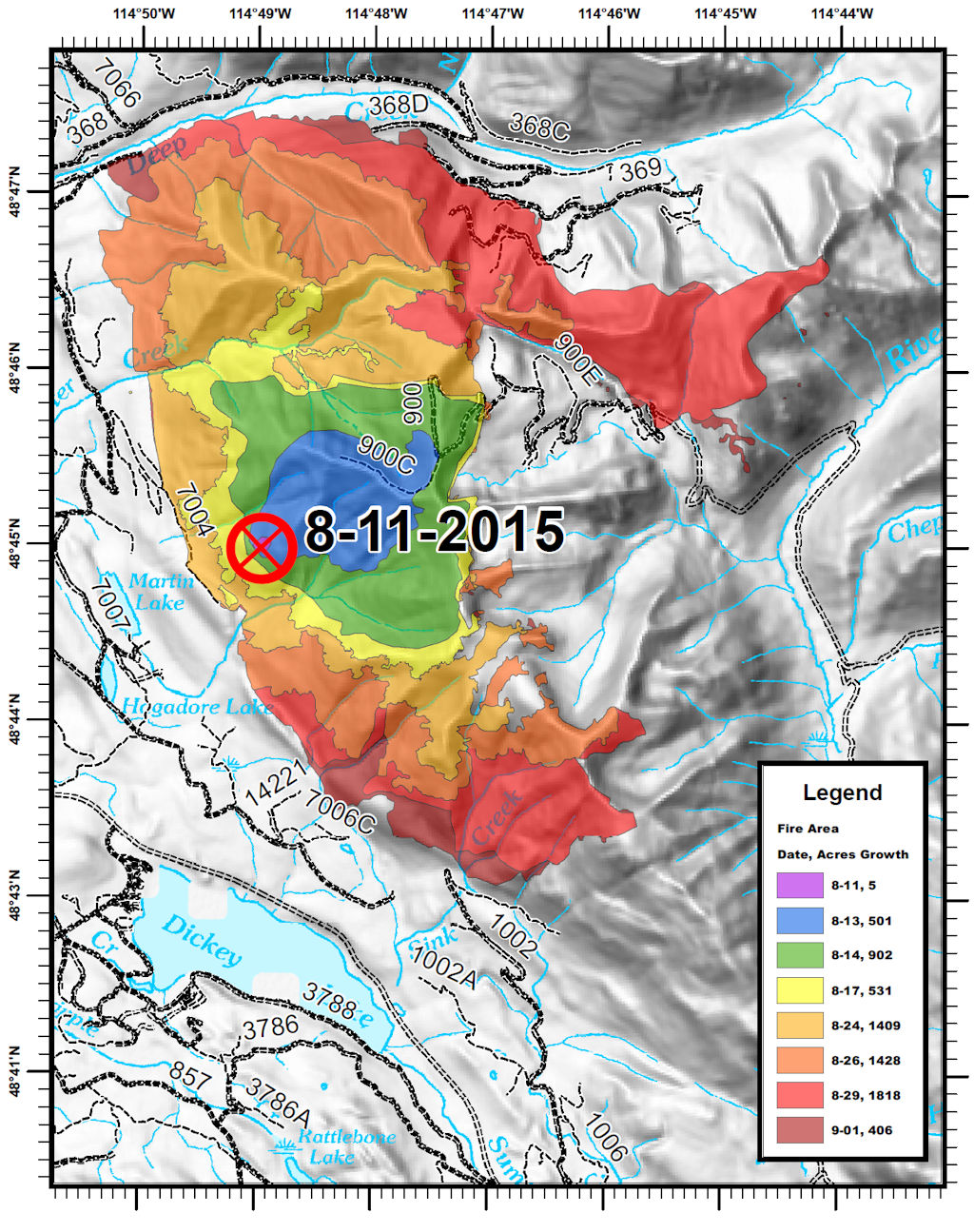
The Thompson-Divide Complex consists of the Sheep and Granite Fires in the Flathead National Forest and the Thompson Fire in Glacier National Park.
All travel restrictions on U.S. Highway 2 related to the fires have been lifted. Motorists are cautioned to still drive carefully because fire traffic are still using this route for rehabilitation efforts.
Stage I Fire Restrictions are in effect for Glacier National Park and Flathead National Forest, except wilderness areas. Stage I Restrictions allow for campfires only in designated fire rings. All fire restrictions have been dropped in the Flathead National Forest Wilderness areas.
Closures are in effect for some trails and areas in the vicinity of the fires. Cutbank Pass and Nyack area trails remain closed. For more information on Glacier NP closures, see http://www.nps.gov/glac/planyourvisit/hikingthetrails.htm or call (406) 888-7800. An area closure around the Sheep and Granite fires on the Flathead National Forest is in effect. Call Hungry Horse Ranger District (406) 387-3800 or go to http://inciweb.nwcg.gov/incident/article/4468/28364/ for details.
The Thompson-Divide Complex received more than an inch of rain in some areas over the past two days and some snow at elevations above 6,000 ft. Today temperatures will be 50-60. There is a 20% chance of showers and thunderstorms. Weather is predicted to return to average temperatures and begin drying mid-week. Smoke from interior hot spots and burning logs may be seen during the week as fuels dry.
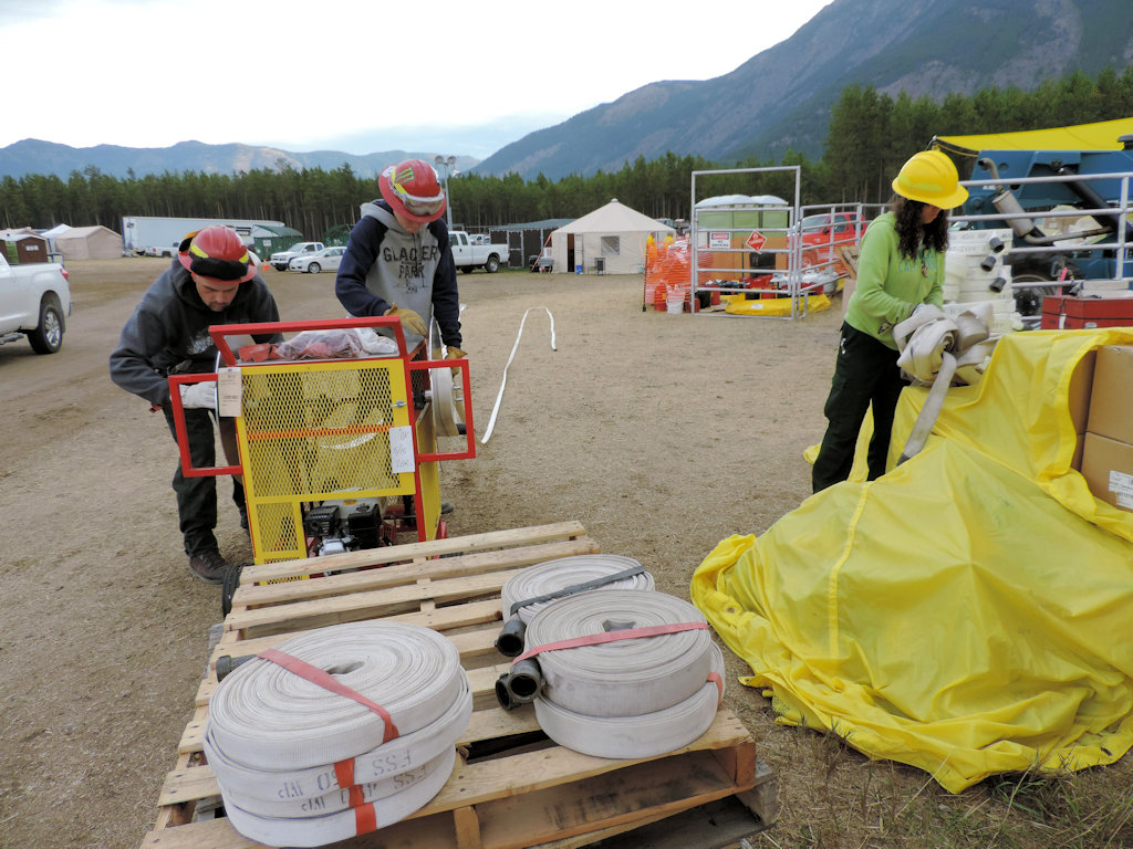
Crews will complete hand rehabilitation and remove protective wrap from cabins today. Fires will be monitored for any activity near the perimeters of the Sheep and Granite Fires. Management of the Thompson-Divide Complex is transferring from the Northern Rockies Type II IMT to a local Type 4 team on Monday, Sept. 7 at 6 p.m. The Type 4 team will be located at the Hungry Horse Ranger Station and will continue to monitor all three fires for any fire activity and complete needed rehabilitation.
Sheep Fire, Flathead National Forest
Approximate Size: 2,171 acres
Granite Fire, Flathead National Forest
Approximate Size: 913 acres
Thompson Fire, Glacier National Park
Approximate Size: 18,847 acres
The Northern Rockies Type II Incident Management Team Leach thanks the community, our partners and cooperators for all their support and assistance during this incident.