Here is the official morning report on the fires in the Thompson-Divide Complex, including the Thompson, Sheep, and Granite blazes.
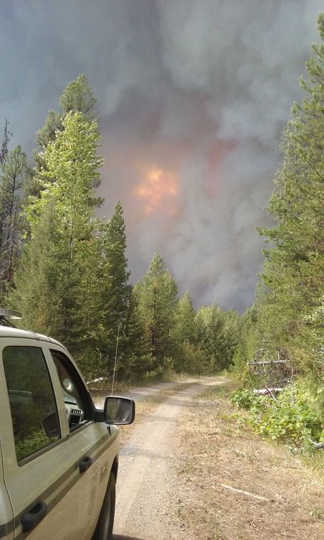
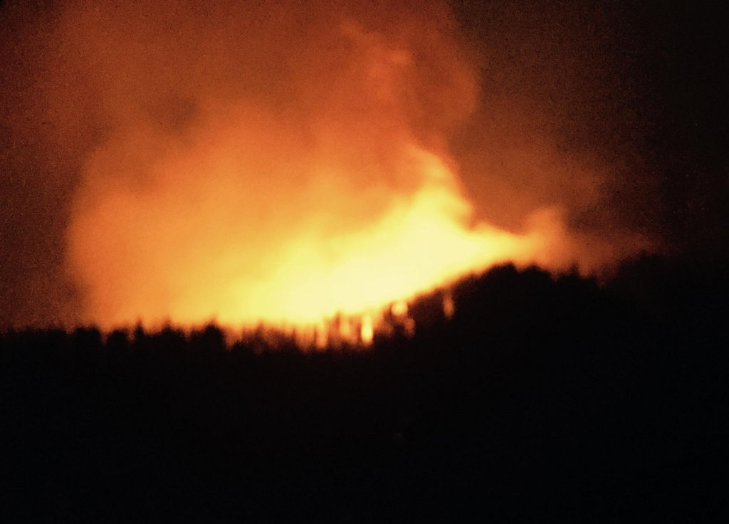
The biggest nuisance right now is the Sheep Fire. Its growth has triggered a mandatory evacuation notice for Essex and the closure (again) of US Route 2 . . .
Fire Information: (406) 387-4854/ (406) 314-1669, 8 a.m. – 8 p.m.
Evacuation and Highway Closure Information: Flathead County EOC, 406-758-2111, 8 a.m.-10 p.m.
Resources – Total Personnel: 335 Injuries: 1 Structures Lost: None
20-Person Hand Crews: 1 Type 1 and Type 2, 1 Wildland Fire Management Module (8), 1 Helitack Crew (10)
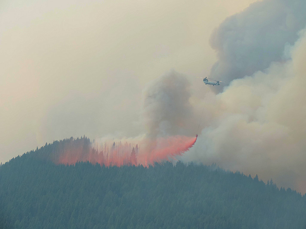
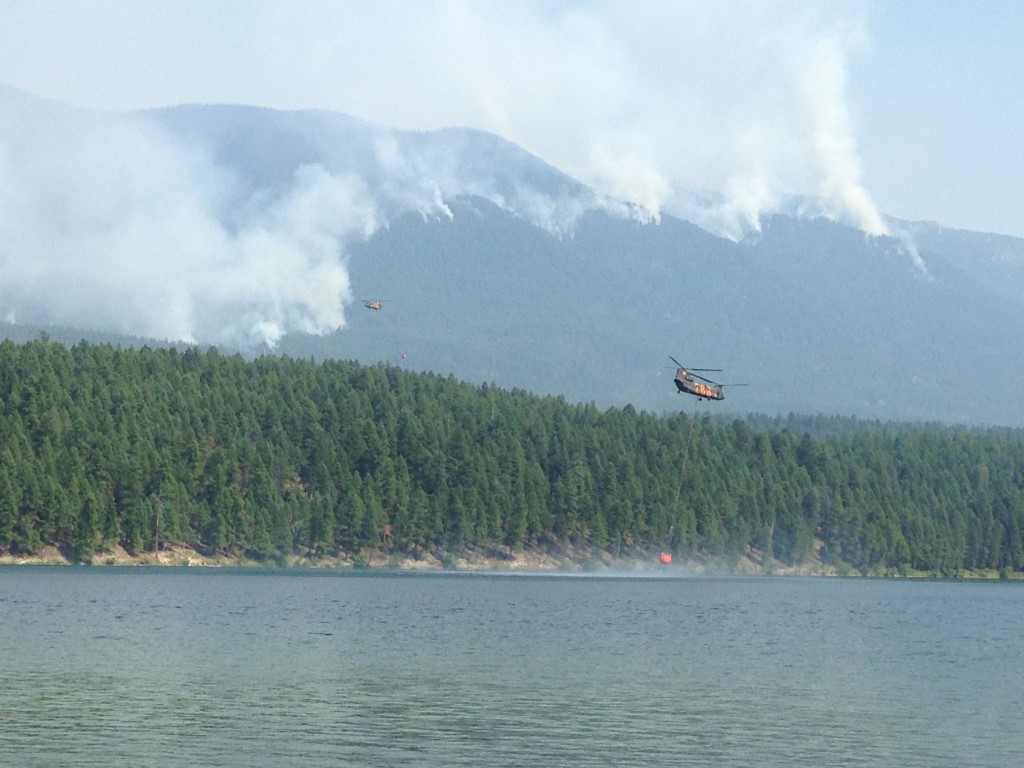
Air Support: Helicopters (1 Type-1 & 2 Type-3), Engines: 16 Heavy Equipment: 4
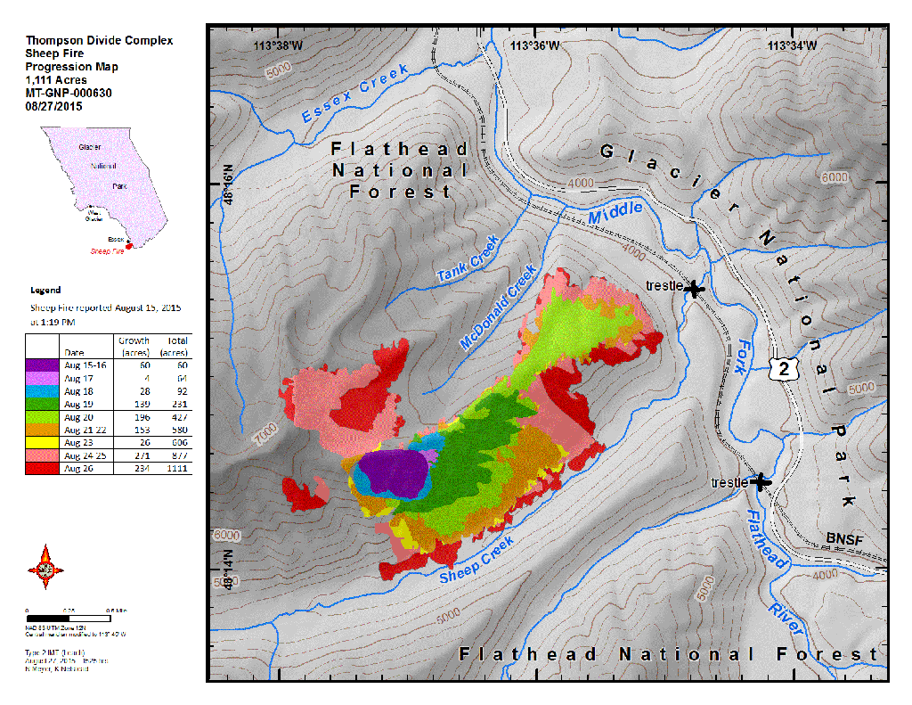
The Thompson-Divide Complex is comprised of the Sheep and Granite Fires on the Flathead National Forest and the Thompson Fire in Glacier National Park. The Sheep fire is the incident priority as it is approaching US Hwy. 2 and the BNSF railway and is threatening the community of Essex.
On August 27 Flathead County Sheriff Chuck Curry ordered a mandatory evacuation of Essex and the surrounding area because of increased activity on the Sheep Fire. Sheriff’s Deputies have contacted residents who are affected by this order. For more information on the evacuation, call the Flathead County Office of Emergency Services at 406-758-2111. The American Red Cross has established an evacuation center at West Glacier Elementary School
Highway 2 is closed between mileposts 176.8 and 185 around Essex. BNSF trains and Amtrak are running intermittently. Call 511 or visit http://www.mdt.mt.gov/travinfo/alerts.shtml for current road status. For more information on Amtrak call 1-(800) 872-7245.
Stage II Fire Restrictions are in effect for northwestern Montana.
Visit http://svc.mt.gov/deq/todaysair/ for air quality info.
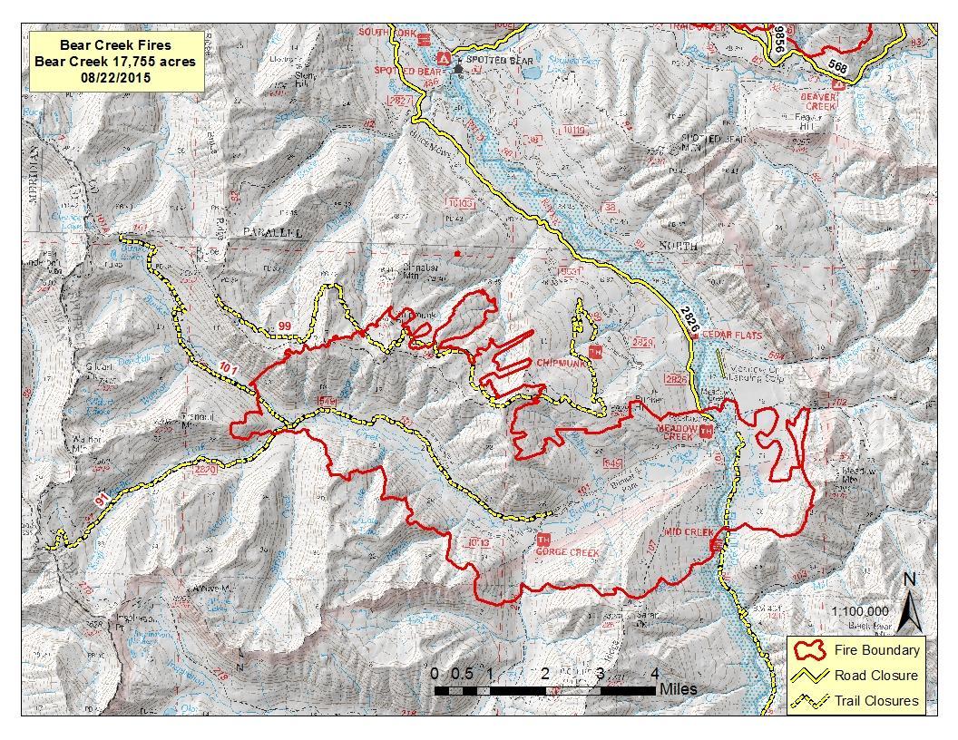
Closures are in effect for some trails in the vicinity of the fires for Glacier National Park and Flathead National Forest. For more info, please see the Glacier NP page http://www.nps.gov/glac/index.htm or for Flathead NF call Hungry Horse Ranger District (406) 387-3800.
A Red Flag Warning has been issued for this afternoon for gusty winds and low relative humidity. These conditions are expected to cause active fire behavior including short crown runs and short range spotting on all three fires in the complex. Weather conditions will be changing going into the weekend. A cold front is approaching on Sunday with maximum temperatures expected to drop 10-15 degrees. In advance of this front, winds are expected to increase Friday and Saturday. Humidity will increase with a slight chance of showers and thunderstorms with this advancing front. Winds will be from the southwest increasing to 15-20 mph with gusts of 25-35 on the ridges possible on Saturday.
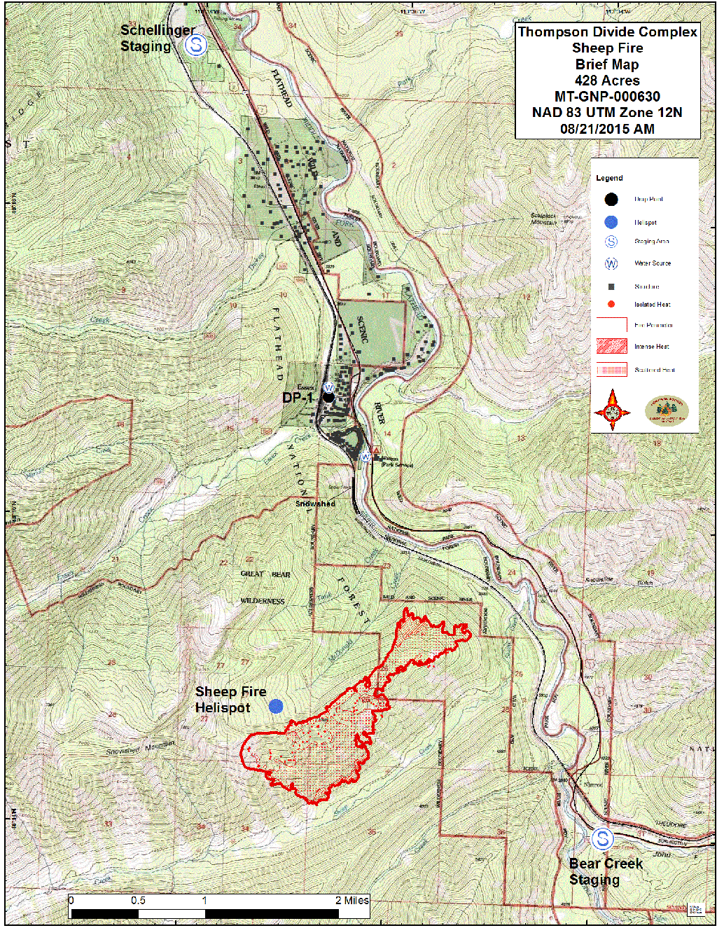
Sheep Fire, Flathead National Forest Link to http://inciweb.nwcg.gov/incident/4468/
Structures At Risk: 200+ structures, BNSF has several wooden snowsheds and 1 wooden trestle, utilities infrastructure
Approximate Size: 1,595 acres Containment: 0% Structures Lost: None
Fire Update: The Sheep Fire is on the Flathead National Forest and burning in very steep terrain with limited access. The fire is about 2 miles south of Essex and less than 1/4 mile from the train tracks between Tank Creek and Sheep Creek. The fire crossed MacDonald Creek and moved down slope yesterday on the ridge south of Tank Creek. It also moved downslope to portions of Sheep Creek, but has not crossed that drainage. It also made an advance west to a ridge coming from Snowshed Mountain. Construction of a shaded fuel break using heavy equipment on the west-side of the BNSF railroad tracks from Sheep Creek to Dickey Creek drainages started Aug. 26. This will continue today between Dickey and MacDonald Creeks as long as conditions permit. The objective of this fuel break is to reduce the fuel component and space the tree crowns to limit fire spread and torching. It will also provide a safe location for firefighters if it is decided to burn out fuels in advance of the fire front. A BNSF work train is being used to move crews and equipment. Helicopters continue to do water drops to check fire spread when visibility allows. Structural protection in Essex will continue. A night shift continues to monitor fire movement and patrol the Essex area and Walton compound for any encroaching fire activity.
Granite Fire, Flathead National Forest Link to http://inciweb.nwcg.gov/incident/4468/
Approximate Size: 701 acres Containment: 0%
Fire Update: The Granite Fire is burning in very steep terrain in a mixed conifer forest. The fire is located west of Marias Pass and south of Hwy. 2. The fire started in the Great Bear Wilderness and has moved north out of the Wilderness. Yesterday, the fire moved to the west along a ridge between 2 unnamed tributaries of Granite Creek and northwest toward Patrol Ridge. Crews have implemented structural protection measures on several backcountry cabins, trailhead structures, a wooden road bridge and a radio repeater. Crews have established locations for fireline construction and possible shaded fuel break opportunities when sufficient crews become available for their construction. Helicopter bucket drops are being used to help check fire spread.
Thompson Fire, Glacier National Park Link to http://inciweb.nwcg.gov/incident/4468/
Approximate Size: 17,284 acres Containment: 20%
Structures At Risk: 2 historic cabins Structures Lost: None
Fire Update: The Thompson Fire is located in remote south-central backcountry of Glacier National Park about 15 miles east of the West Glacier entrance in the Thompson and Nyack drainages west of the Continental Divide. Increased fire activity was seen within the fire perimeter south of Tinkham Mountain today. Firefighters in the Nyack Creek drainage finished burnout and mop up operations in the northwest corner (Division A) of the fire and were flown out yesterday. Pumps and hose lay are in place in case a future need arises and the fire will be monitored by air.
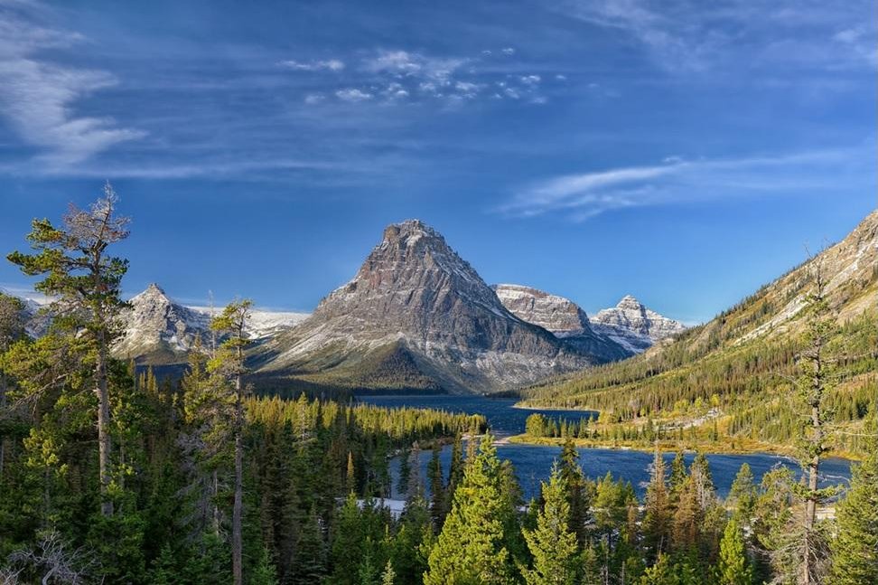
Most of Glacier National Park is unaffected by this wildfire complex and is available for recreational use. Limited backcountry closures are in place. For more specific visitor information, please see the website http://www.nps.gov/glac/index.htm.
The Thompson Fire has not impacted park roads. The Going-to-the-Sun Road is open.
For information on the Reynolds Creek fire, please visit http://inciweb.nwcg.gov/incident/4405/#